
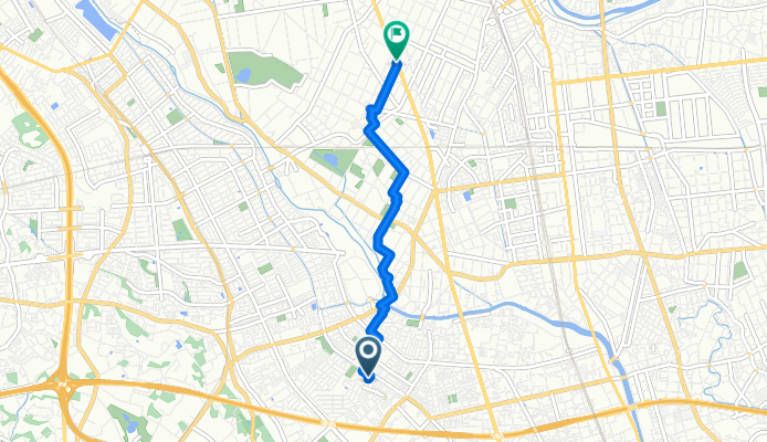
396, Angyokichizo, Kawaguchi-Shi to Nikko-kaido Avenue, Koshigaya-Shi
A cycling route starting in Sōka, Saitama, Japan.
Overview
About this route
- 16 min
- Duration
- 4.5 km
- Distance
- 10 m
- Ascent
- 8 m
- Descent
- 16.8 km/h
- Avg. speed
- ---
- Max. altitude

Route quality
Waytypes & surfaces along the route
Waytypes
Quiet road
2.8 km
(63 %)
Road
1.5 km
(33 %)
Surfaces
Paved
0.1 km
(2 %)
Paved (undefined)
0.1 km
(2 %)
Undefined
4.4 km
(98 %)
Continue with Bikemap
Use, edit, or download this cycling route
You would like to ride 396, Angyokichizo, Kawaguchi-Shi to Nikko-kaido Avenue, Koshigaya-Shi or customize it for your own trip? Here is what you can do with this Bikemap route:
Free features
- Save this route as favorite or in collections
- Copy & plan your own version of this route
- Sync your route with Garmin or Wahoo
Premium features
Free trial for 3 days, or one-time payment. More about Bikemap Premium.
- Navigate this route on iOS & Android
- Export a GPX / KML file of this route
- Create your custom printout (try it for free)
- Download this route for offline navigation
Discover more Premium features.
Get Bikemap PremiumFrom our community
Other popular routes starting in Sōka
 22 草加せんべい松並木のルート
- Distance
- 4.8 km
- Ascent
- 25 m
- Descent
- 33 m
- Location
- Sōka, Saitama, Japan
 fukaya big turtle dome
- Distance
- 1.4 km
- Ascent
- 21 m
- Descent
- 8 m
- Location
- Sōka, Saitama, Japan
 16-1, Iko 4-Chōme, Adachi to 19-7, Hachimangi 2-Chōme, Kawaguchi
- Distance
- 4.5 km
- Ascent
- 3 m
- Descent
- 3 m
- Location
- Sōka, Saitama, Japan
 2-chōme 13, Adachi City to 3-chōme 3, Koto City
- Distance
- 20 km
- Ascent
- 58 m
- Descent
- 58 m
- Location
- Sōka, Saitama, Japan
 県道34号, Kawaguchi to 319, Ushijima, Kasukabe
- Distance
- 18.8 km
- Ascent
- 31 m
- Descent
- 29 m
- Location
- Sōka, Saitama, Japan
 Easy ride in Koshigaya-Shi
- Distance
- 9.5 km
- Ascent
- 108 m
- Descent
- 114 m
- Location
- Sōka, Saitama, Japan
 396, Angyokichizo, Kawaguchi-Shi to Nikko-kaido Avenue, Koshigaya-Shi
- Distance
- 4.5 km
- Ascent
- 10 m
- Descent
- 8 m
- Location
- Sōka, Saitama, Japan
 7-12, Ihara 2-Chōme, Koshigaya to 61, Tomuro, Kazo
- Distance
- 84.8 km
- Ascent
- 38 m
- Descent
- 40 m
- Location
- Sōka, Saitama, Japan
Open it in the app