

Healthy Road へルーシロード
A cycling route starting in Hatogaya-honchō, Saitama, Japan.
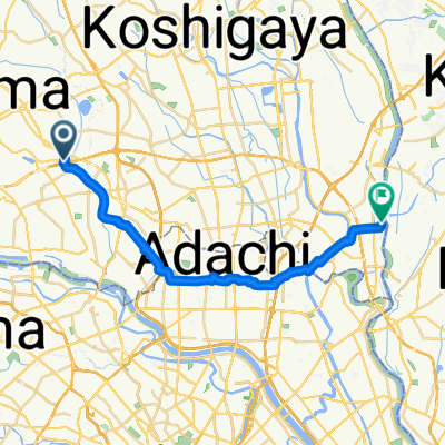
Overview
About this route
This is a very interesting route that has a lot of scenic spots, you can’t help but stop to take a quick picture of Mt.Fuji in the distance or the gates of the various temples.
The route is very flat, it’s very popular too so expect some foot traffic, there are a few bumpy sections especially around the 3K mark and along the 5K to 6K mark but their are alternative roads that go along perpendicular to the route, you just sacrifice the view a little.
I ended this route at the train track crossing but you can go further just expect a lot of narrow paths and stops at crossroads, I cycled beyond the crossing only once on a rainy evening so it was pretty clear of traffic but I can see it being busy on a sunny day and you may have to travel at a snails pace or you may upset some walkers along the narrow sections, it’s just something to keep in mind or note about.
- 1 h 25 min
- Duration
- 13.6 km
- Distance
- 36 m
- Ascent
- 32 m
- Descent
- 9.6 km/h
- Avg. speed
- ---
- Max. altitude
Route quality
Waytypes & surfaces along the route
Waytypes
Access road
6.3 km
(46 %)
Cycleway
3.3 km
(24 %)
Surfaces
Paved
0.7 km
(5 %)
Asphalt
0.7 km
(5 %)
Undefined
12.9 km
(95 %)
Continue with Bikemap
Use, edit, or download this cycling route
You would like to ride Healthy Road へルーシロード or customize it for your own trip? Here is what you can do with this Bikemap route:
Free features
- Save this route as favorite or in collections
- Copy & plan your own version of this route
- Sync your route with Garmin or Wahoo
Premium features
Free trial for 3 days, or one-time payment. More about Bikemap Premium.
- Navigate this route on iOS & Android
- Export a GPX / KML file of this route
- Create your custom printout (try it for free)
- Download this route for offline navigation
Discover more Premium features.
Get Bikemap PremiumFrom our community
Other popular routes starting in Hatogaya-honchō
 Healthy Road へルーシロード
- Distance
- 13.6 km
- Ascent
- 36 m
- Descent
- 32 m
- Location
- Hatogaya-honchō, Saitama, Japan
 30, Kawaguchi to 5-chōme 12, Kawaguchi
- Distance
- 3 km
- Ascent
- 22 m
- Descent
- 23 m
- Location
- Hatogaya-honchō, Saitama, Japan
 Shibakawa Cycling Road
- Distance
- 15.5 km
- Ascent
- 96 m
- Descent
- 88 m
- Location
- Hatogaya-honchō, Saitama, Japan
 Hatogaya-honchō - Matsudo (1/2)
- Distance
- 24.2 km
- Ascent
- 44 m
- Descent
- 49 m
- Location
- Hatogaya-honchō, Saitama, Japan
 Higashi Urawa River Cycle 東浦和近くの川
- Distance
- 14.6 km
- Ascent
- 63 m
- Descent
- 67 m
- Location
- Hatogaya-honchō, Saitama, Japan
 13 芝川で「農」を体感するルート
- Distance
- 12.5 km
- Ascent
- 23 m
- Descent
- 25 m
- Location
- Hatogaya-honchō, Saitama, Japan
 BRM322-1
- Distance
- 153.1 km
- Ascent
- 990 m
- Descent
- 366 m
- Location
- Hatogaya-honchō, Saitama, Japan
 763−2, 川口市 to 1丁目 20, 秩父市
- Distance
- 94 km
- Ascent
- 3,113 m
- Descent
- 2,878 m
- Location
- Hatogaya-honchō, Saitama, Japan
Open it in the app