

2019 10 Herbsttour Ostsachsen
Herbsttour Ostsachsen + Böhmische Schweiz, Tag 4
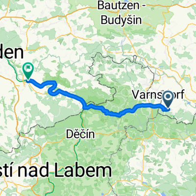
A cycling route starting in Kurort Jonsdorf, Saxony, Germany.
Overview
About this route
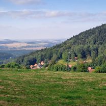
The day started with rain, which is just part of autumn. I softened the route through Bohemian Switzerland on small side roads compared to Dirk's tour due to the wet conditions. There were some short but very tough climbs. Since everyone here uses komoot, the patchy signage shouldn’t be a problem. Back on the Elbe Cycle Route to Pirna. The conclusion of the autumn tour: It was a good idea to make use of the beautiful days of the Golden Autumn. Very nice routes along the Spree and Wolfsradweg as well as in the Zittau Mountains. Overall, it was a rather sporty tour over 330 km with nearly 3000 m of elevation gain.
- -:--
- Duration
- 71.5 km
- Distance
- 805 m
- Ascent
- 1,066 m
- Descent
- ---
- Avg. speed
- ---
- Max. altitude

Part of
3 stages
Route quality
Waytypes & surfaces along the route
Waytypes
Road
25 km
(35 %)
Quiet road
14.3 km
(20 %)
Surfaces
Paved
60.1 km
(84 %)
Unpaved
1.4 km
(2 %)
Asphalt
60.1 km
(84 %)
Ground
1.4 km
(2 %)
Undefined
10 km
(14 %)
Continue with Bikemap
Use, edit, or download this cycling route
You would like to ride Herbsttour Ostsachsen + Böhmische Schweiz, Tag 4 or customize it for your own trip? Here is what you can do with this Bikemap route:
Free features
- Save this route as favorite or in collections
- Copy & plan your own version of this route
- Sync your route with Garmin or Wahoo
Premium features
Free trial for 3 days, or one-time payment. More about Bikemap Premium.
- Navigate this route on iOS & Android
- Export a GPX / KML file of this route
- Create your custom printout (try it for free)
- Download this route for offline navigation
Discover more Premium features.
Get Bikemap PremiumFrom our community
Other popular routes starting in Kurort Jonsdorf
 Herbsttour Ostsachsen + Böhmische Schweiz, Tag 4
- Distance
- 71.5 km
- Ascent
- 805 m
- Descent
- 1,066 m
- Location
- Kurort Jonsdorf, Saxony, Germany
 Jonsdorf - Labska bouda
- Distance
- 219.2 km
- Ascent
- 2,662 m
- Descent
- 2,659 m
- Location
- Kurort Jonsdorf, Saxony, Germany
 Jested Alternativ
- Distance
- 90.2 km
- Ascent
- 1,275 m
- Descent
- 1,289 m
- Location
- Kurort Jonsdorf, Saxony, Germany
 In der böhmischen Wildnis
- Distance
- 59.3 km
- Ascent
- 1,285 m
- Descent
- 1,285 m
- Location
- Kurort Jonsdorf, Saxony, Germany
 Trávník-Naděje-H.Světlá - D.Světlá-Mařenice-Lindava -Svitava-Maxov-Radvanec - Trávník CLONED FROM ROUTE 1516196
- Distance
- 36.9 km
- Ascent
- 441 m
- Descent
- 437 m
- Location
- Kurort Jonsdorf, Saxony, Germany
 Jonsdorf nach Stadt Wehlen
- Distance
- 82 km
- Ascent
- 622 m
- Descent
- 952 m
- Location
- Kurort Jonsdorf, Saxony, Germany
 Kurze Radrunde durch Jonsdorf
- Distance
- 7 km
- Ascent
- 295 m
- Descent
- 285 m
- Location
- Kurort Jonsdorf, Saxony, Germany
 Jiřetín pod Jedlovou Eisgasse
- Distance
- 36.5 km
- Ascent
- 677 m
- Descent
- 893 m
- Location
- Kurort Jonsdorf, Saxony, Germany
Open it in the app