

Oyama(Kanagawa)
A cycling route starting in Isehara, Kanagawa, Japan.
Overview
About this route
- -:--
- Duration
- 24.4 km
- Distance
- 466 m
- Ascent
- 482 m
- Descent
- ---
- Avg. speed
- ---
- Max. altitude

Continue with Bikemap
Use, edit, or download this cycling route
You would like to ride Oyama(Kanagawa) or customize it for your own trip? Here is what you can do with this Bikemap route:
Free features
- Save this route as favorite or in collections
- Copy & plan your own version of this route
- Sync your route with Garmin or Wahoo
Premium features
Free trial for 3 days, or one-time payment. More about Bikemap Premium.
- Navigate this route on iOS & Android
- Export a GPX / KML file of this route
- Create your custom printout (try it for free)
- Download this route for offline navigation
Discover more Premium features.
Get Bikemap PremiumFrom our community
Other popular routes starting in Isehara
 Itinéraire reposant en Isehara-Shi
- Distance
- 43.9 km
- Ascent
- 856 m
- Descent
- 434 m
- Location
- Isehara, Kanagawa, Japan
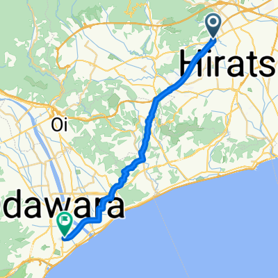 Isehara - Odawara
- Distance
- 21.6 km
- Ascent
- 52 m
- Descent
- 89 m
- Location
- Isehara, Kanagawa, Japan
 Iiyama Umei Festival
- Distance
- 19.5 km
- Ascent
- 245 m
- Descent
- 230 m
- Location
- Isehara, Kanagawa, Japan
 test
test- Distance
- 57.2 km
- Ascent
- 715 m
- Descent
- 321 m
- Location
- Isehara, Kanagawa, Japan
 高森2丁目33-13, 伊勢原市 to 高森2丁目33-13, 伊勢原市
- Distance
- 10.8 km
- Ascent
- 107 m
- Descent
- 129 m
- Location
- Isehara, Kanagawa, Japan
 5-2, Sanada 2-Chōme, Hiratsuka to 9, Sanada 1-Chōme, Hiratsuka
- Distance
- 9.9 km
- Ascent
- 65 m
- Descent
- 68 m
- Location
- Isehara, Kanagawa, Japan
 Aikoishida - Daibut
- Distance
- 56.1 km
- Ascent
- 112 m
- Descent
- 107 m
- Location
- Isehara, Kanagawa, Japan
 Isehara - Gotenba
- Distance
- 50.7 km
- Ascent
- 1,561 m
- Descent
- 1,186 m
- Location
- Isehara, Kanagawa, Japan
Open it in the app