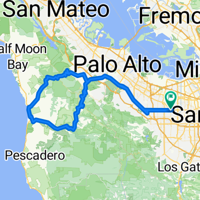
251 Olson Way, Sunnyvale to San Francisco Bay Trail, Burlingame
A cycling route starting in Sunnyvale, California, United States.
Overview
About this route
- 3 h 19 min
 - Duration
 - 54.2 km
 - Distance
 - 25 m
 - Ascent
 - 54 m
 - Descent
 - 16.4 km/h
 - Avg. speed
 - ---
 - Max. altitude
 
Route quality
Waytypes & surfaces along the route
Waytypes
Cycleway
28.8 km
(53 %)
Quiet road
8.1 km
(15 %)
Surfaces
Paved
34.7 km
(64 %)
Unpaved
10.3 km
(19 %)
Asphalt
27.7 km
(51 %)
Gravel
10.3 km
(19 %)
Continue with Bikemap
Use, edit, or download this cycling route
You would like to ride 251 Olson Way, Sunnyvale to San Francisco Bay Trail, Burlingame or customize it for your own trip? Here is what you can do with this Bikemap route:
Free features
- Save this route as favorite or in collections
 - Copy & plan your own version of this route
 - Sync your route with Garmin or Wahoo
 
Premium features
Free trial for 3 days, or one-time payment. More about Bikemap Premium.
- Navigate this route on iOS & Android
 - Export a GPX / KML file of this route
 - Create your custom printout (try it for free)
 - Download this route for offline navigation
 
Discover more Premium features.
Get Bikemap PremiumFrom our community
Other popular routes starting in Sunnyvale
251 Olson Way, Sunnyvale to San Francisco Bay Trail, Burlingame- Distance
 - 54.2 km
 - Ascent
 - 25 m
 - Descent
 - 54 m
 - Location
 - Sunnyvale, California, United States
 
Stevens Creek Canyon Road- Distance
 - 54.2 km
 - Ascent
 - 1,463 m
 - Descent
 - 1,113 m
 - Location
 - Sunnyvale, California, United States
 
Stevens Creek - NASA - drive- Distance
 - 24.8 km
 - Ascent
 - 90 m
 - Descent
 - 92 m
 - Location
 - Sunnyvale, California, United States
 
Foothill - Alpine - Arastradero - Foothill- Distance
 - 53.6 km
 - Ascent
 - 470 m
 - Descent
 - 470 m
 - Location
 - Sunnyvale, California, United States
 
Loop around Alviso- Distance
 - 26.7 km
 - Ascent
 - 40 m
 - Descent
 - 38 m
 - Location
 - Sunnyvale, California, United States
 
Montebello Rd - Black mountain- Distance
 - 19 km
 - Ascent
 - 815 m
 - Descent
 - 83 m
 - Location
 - Sunnyvale, California, United States
 
To Rancho San Antonio Open Space Preserve- Distance
 - 9.8 km
 - Ascent
 - 144 m
 - Descent
 - 64 m
 - Location
 - Sunnyvale, California, United States
 
Possible Hash Bluemax short- Distance
 - 8.2 km
 - Ascent
 - 8 m
 - Descent
 - 8 m
 - Location
 - Sunnyvale, California, United States
 
Open it in the app

