

Tag Zwei
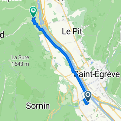
A cycling route starting in Sassenage, Auvergne-Rhône-Alpes, France.
Overview
About this route
- -:--
- Duration
- 111.9 km
- Distance
- 1,245 m
- Ascent
- 1,245 m
- Descent
- ---
- Avg. speed
- ---
- Max. altitude

Route quality
Waytypes & surfaces along the route
Waytypes
Quiet road
30.2 km
(27 %)
Road
16.8 km
(15 %)
Surfaces
Paved
67.2 km
(60 %)
Unpaved
3.4 km
(3 %)
Asphalt
67.2 km
(60 %)
Pebblestone
2.2 km
(2 %)
Continue with Bikemap
Use, edit, or download this cycling route
You would like to ride Tag Zwei or customize it for your own trip? Here is what you can do with this Bikemap route:
Free features
- Save this route as favorite or in collections
- Copy & plan your own version of this route
- Split it into stages to create a multi-day tour
- Sync your route with Garmin or Wahoo
Premium features
Free trial for 3 days, or one-time payment. More about Bikemap Premium.
- Navigate this route on iOS & Android
- Export a GPX / KML file of this route
- Create your custom printout (try it for free)
- Download this route for offline navigation
Discover more Premium features.
Get Bikemap PremiumFrom our community
Other popular routes starting in Sassenage
 De Rue François Blumet à Allée des Marronniers
- Distance
- 10.7 km
- Ascent
- 113 m
- Descent
- 64 m
- Location
- Sassenage, Auvergne-Rhône-Alpes, France
 Sasenage - Choranche_MT
- Distance
- 45.2 km
- Ascent
- 867 m
- Descent
- 845 m
- Location
- Sassenage, Auvergne-Rhône-Alpes, France
 ghjcghj
- Distance
- 74.5 km
- Ascent
- 1,279 m
- Descent
- 1,261 m
- Location
- Sassenage, Auvergne-Rhône-Alpes, France
 110224 Montaud
- Distance
- 75.5 km
- Ascent
- 566 m
- Descent
- 547 m
- Location
- Sassenage, Auvergne-Rhône-Alpes, France
 De Gröll à Gröll par le col de clémencière
- Distance
- 37.7 km
- Ascent
- 613 m
- Descent
- 613 m
- Location
- Sassenage, Auvergne-Rhône-Alpes, France
 Sassenage - Paladru
- Distance
- 40.3 km
- Ascent
- 361 m
- Descent
- 69 m
- Location
- Sassenage, Auvergne-Rhône-Alpes, France
 Grenoble - Vercors 2
- Distance
- 91.9 km
- Ascent
- 1,481 m
- Descent
- 1,485 m
- Location
- Sassenage, Auvergne-Rhône-Alpes, France
 Sassenage - St Quentin - Montaud
- Distance
- 44 km
- Ascent
- 417 m
- Descent
- 293 m
- Location
- Sassenage, Auvergne-Rhône-Alpes, France
Open it in the app