

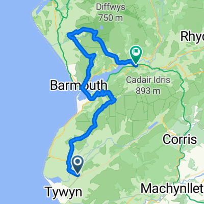
Pont Scethin (Cleaned)
A cycling route starting in Tywyn, Wales, United Kingdom.
Overview
About this route
Manual Route
- -:--
- Duration
- 47.5 km
- Distance
- 1,228 m
- Ascent
- 1,222 m
- Descent
- ---
- Avg. speed
- ---
- Max. altitude
Continue with Bikemap
Use, edit, or download this cycling route
You would like to ride Pont Scethin (Cleaned) or customize it for your own trip? Here is what you can do with this Bikemap route:
Free features
- Save this route as favorite or in collections
- Copy & plan your own version of this route
- Sync your route with Garmin or Wahoo
Premium features
Free trial for 3 days, or one-time payment. More about Bikemap Premium.
- Navigate this route on iOS & Android
- Export a GPX / KML file of this route
- Create your custom printout (try it for free)
- Download this route for offline navigation
Discover more Premium features.
Get Bikemap PremiumFrom our community
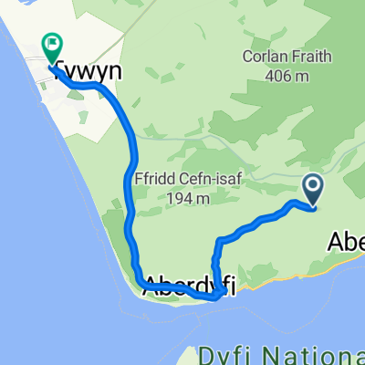
Other popular routes starting in Tywyn
 Pont Scethin (Cleaned)
- Distance
- 47.5 km
- Ascent
- 1,228 m
- Descent
- 1,222 m
- Location
- Tywyn, Wales, United Kingdom
 Recovered Route
- Distance
- 11.1 km
- Ascent
- 41 m
- Descent
- 287 m
- Location
- Tywyn, Wales, United Kingdom
 Kleine Tour bei Aberdovey
- Distance
- 5.4 km
- Ascent
- 286 m
- Descent
- 112 m
- Location
- Tywyn, Wales, United Kingdom
 kleine Runde durchs Happy Valley
- Distance
- 24.6 km
- Ascent
- 367 m
- Descent
- 367 m
- Location
- Tywyn, Wales, United Kingdom
 England France Monday 03 July
- Distance
- 101 km
- Ascent
- 1,713 m
- Descent
- 1,472 m
- Location
- Tywyn, Wales, United Kingdom
 Blistering ride in Tywyn
- Distance
- 16.8 km
- Ascent
- 0 m
- Descent
- 7 m
- Location
- Tywyn, Wales, United Kingdom
 Around Wales - Day 9 - Aberdovey - Criccieth
- Distance
- 152.9 km
- Ascent
- 515 m
- Descent
- 509 m
- Location
- Tywyn, Wales, United Kingdom
 country hills
- Distance
- 15 km
- Ascent
- 0 m
- Descent
- 10 m
- Location
- Tywyn, Wales, United Kingdom
Open it in the app