

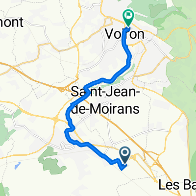
Fünfter Tag
A cycling route starting in Saint-Jean-de-Moirans, Auvergne-Rhône-Alpes, France.
Overview
About this route
- -:--
- Duration
- 90.5 km
- Distance
- 909 m
- Ascent
- 957 m
- Descent
- ---
- Avg. speed
- ---
- Max. altitude

Route quality
Waytypes & surfaces along the route
Waytypes
Quiet road
31.7 km
(35 %)
Road
17.2 km
(19 %)
Surfaces
Paved
52.5 km
(58 %)
Asphalt
52.5 km
(58 %)
Undefined
38 km
(42 %)
Continue with Bikemap
Use, edit, or download this cycling route
You would like to ride Fünfter Tag or customize it for your own trip? Here is what you can do with this Bikemap route:
Free features
- Save this route as favorite or in collections
- Copy & plan your own version of this route
- Split it into stages to create a multi-day tour
- Sync your route with Garmin or Wahoo
Premium features
Free trial for 3 days, or one-time payment. More about Bikemap Premium.
- Navigate this route on iOS & Android
- Export a GPX / KML file of this route
- Create your custom printout (try it for free)
- Download this route for offline navigation
Discover more Premium features.
Get Bikemap PremiumFrom our community
Other popular routes starting in Saint-Jean-de-Moirans
 259 Rue du Rocher de Lorzier, Moirans à 18 Rue Rose-Sage, Voiron
- Distance
- 7.3 km
- Ascent
- 130 m
- Descent
- 25 m
- Location
- Saint-Jean-de-Moirans, Auvergne-Rhône-Alpes, France
 rando hibou
- Distance
- 11.3 km
- Ascent
- 247 m
- Descent
- 72 m
- Location
- Saint-Jean-de-Moirans, Auvergne-Rhône-Alpes, France
 Grenoble - Col de Manse
- Distance
- 122.4 km
- Ascent
- 1,855 m
- Descent
- 777 m
- Location
- Saint-Jean-de-Moirans, Auvergne-Rhône-Alpes, France
 137 Rue de Mayoussard, Moirans à 18 Rue Rose-Sage, Voiron
- Distance
- 7.3 km
- Ascent
- 125 m
- Descent
- 20 m
- Location
- Saint-Jean-de-Moirans, Auvergne-Rhône-Alpes, France
 Grenoble-Col d'Ornon-L'Alpe d'Huez
- Distance
- 122.2 km
- Ascent
- 2,616 m
- Descent
- 1,025 m
- Location
- Saint-Jean-de-Moirans, Auvergne-Rhône-Alpes, France
 Grenoble-Reallon
- Distance
- 169.8 km
- Ascent
- 2,452 m
- Descent
- 1,769 m
- Location
- Saint-Jean-de-Moirans, Auvergne-Rhône-Alpes, France
 Grenoble-Col de la Madeleine
- Distance
- 137.6 km
- Ascent
- 3,294 m
- Descent
- 1,736 m
- Location
- Saint-Jean-de-Moirans, Auvergne-Rhône-Alpes, France
 137 Rue de Mayoussard, Moirans à 18 Rue Rose-Sage, Voiron
- Distance
- 8.8 km
- Ascent
- 132 m
- Descent
- 30 m
- Location
- Saint-Jean-de-Moirans, Auvergne-Rhône-Alpes, France
Open it in the app