

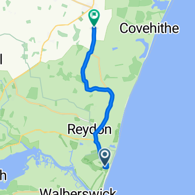
Southwold - Bradfield loop 24
A cycling route starting in Southwold, England, United Kingdom.
Overview
About this route
Cycling from 2020-08-23T06:30:54.851Z to 2020-08-23T09:29:05.611Z. Distance 36812m
- -:--
- Duration
- 38.6 km
- Distance
- 147 m
- Ascent
- 146 m
- Descent
- ---
- Avg. speed
- ---
- Max. altitude

Route quality
Waytypes & surfaces along the route
Waytypes
Quiet road
25.1 km
(65 %)
Track
2.3 km
(6 %)
Surfaces
Paved
10.4 km
(27 %)
Unpaved
3.5 km
(9 %)
Asphalt
10.4 km
(27 %)
Gravel
1.2 km
(3 %)
Continue with Bikemap
Use, edit, or download this cycling route
You would like to ride Southwold - Bradfield loop 24 or customize it for your own trip? Here is what you can do with this Bikemap route:
Free features
- Save this route as favorite or in collections
- Copy & plan your own version of this route
- Sync your route with Garmin or Wahoo
Premium features
Free trial for 3 days, or one-time payment. More about Bikemap Premium.
- Navigate this route on iOS & Android
- Export a GPX / KML file of this route
- Create your custom printout (try it for free)
- Download this route for offline navigation
Discover more Premium features.
Get Bikemap PremiumFrom our community
Other popular routes starting in Southwold
 Leila ride
- Distance
- 88.5 km
- Ascent
- 225 m
- Descent
- 225 m
- Location
- Southwold, England, United Kingdom
 Walbesworld 2018
- Distance
- 8.2 km
- Ascent
- 18 m
- Descent
- 16 m
- Location
- Southwold, England, United Kingdom
 Day 5 - Saturday 11th September (PM)
- Distance
- 29.1 km
- Ascent
- 79 m
- Descent
- 67 m
- Location
- Southwold, England, United Kingdom
 Southwold Crit
- Distance
- 7.3 km
- Ascent
- 23 m
- Descent
- 26 m
- Location
- Southwold, England, United Kingdom
 Southwold - Bradfield loop 24
- Distance
- 38.6 km
- Ascent
- 147 m
- Descent
- 146 m
- Location
- Southwold, England, United Kingdom
 toertje Wangford , Beccles, Southwold
- Distance
- 51.2 km
- Ascent
- 136 m
- Descent
- 132 m
- Location
- Southwold, England, United Kingdom
 Park Lane 20 to Southwold Road 96, Wrentham
- Distance
- 7.4 km
- Ascent
- 39 m
- Descent
- 42 m
- Location
- Southwold, England, United Kingdom
 Lost Lanes - 26: Sun, Sea & Suffolk
- Distance
- 78.5 km
- Ascent
- 372 m
- Descent
- 372 m
- Location
- Southwold, England, United Kingdom
Open it in the app