

A day in the peak
A cycling route starting in Chorlton cum Hardy, England, United Kingdom.
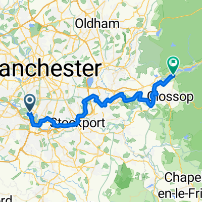
Overview
About this route
- -:--
- Duration
- 133.4 km
- Distance
- 1,565 m
- Ascent
- 1,525 m
- Descent
- ---
- Avg. speed
- 511 m
- Max. altitude
Route quality
Waytypes & surfaces along the route
Waytypes
Road
22.7 km
(17 %)
Quiet road
17.3 km
(13 %)
Surfaces
Paved
65.3 km
(49 %)
Asphalt
65.3 km
(49 %)
Undefined
68 km
(51 %)
Continue with Bikemap
Use, edit, or download this cycling route
You would like to ride A day in the peak or customize it for your own trip? Here is what you can do with this Bikemap route:
Free features
- Save this route as favorite or in collections
- Copy & plan your own version of this route
- Split it into stages to create a multi-day tour
- Sync your route with Garmin or Wahoo
Premium features
Free trial for 3 days, or one-time payment. More about Bikemap Premium.
- Navigate this route on iOS & Android
- Export a GPX / KML file of this route
- Create your custom printout (try it for free)
- Download this route for offline navigation
Discover more Premium features.
Get Bikemap PremiumFrom our community
Other popular routes starting in Chorlton cum Hardy
 A day in the peak
- Distance
- 133.4 km
- Ascent
- 1,565 m
- Descent
- 1,525 m
- Location
- Chorlton cum Hardy, England, United Kingdom
 42 Hollyhey Drive, Manchester to 40 Hollyhey Drive, Manchester
- Distance
- 18.8 km
- Ascent
- 266 m
- Descent
- 265 m
- Location
- Chorlton cum Hardy, England, United Kingdom
 NCN Route 62: Trans Pennine Trail, Chorlton cum Hardy to Glossop
- Distance
- 40.3 km
- Ascent
- 515 m
- Descent
- 336 m
- Location
- Chorlton cum Hardy, England, United Kingdom
 Cat and Fiddle Circular
- Distance
- 82.1 km
- Ascent
- 795 m
- Descent
- 793 m
- Location
- Chorlton cum Hardy, England, United Kingdom
 Short bike tour through Manchester
- Distance
- 9.8 km
- Ascent
- 18 m
- Descent
- 18 m
- Location
- Chorlton cum Hardy, England, United Kingdom
 Quick ride through Manchester
- Distance
- 7.3 km
- Ascent
- 16 m
- Descent
- 17 m
- Location
- Chorlton cum Hardy, England, United Kingdom
 Man7Strong2011
- Distance
- 44.2 km
- Ascent
- 92 m
- Descent
- 94 m
- Location
- Chorlton cum Hardy, England, United Kingdom
 Manchester to Hurstwood
- Distance
- 55.4 km
- Ascent
- 631 m
- Descent
- 428 m
- Location
- Chorlton cum Hardy, England, United Kingdom
Open it in the app