
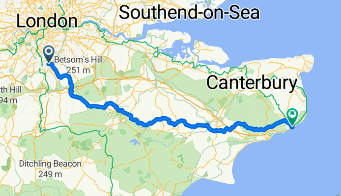
London-Crydon nach Dover
A cycling route starting in South Croydon, England, United Kingdom.
Overview
About this route
- -:--
- Duration
- 140.6 km
- Distance
- 1,047 m
- Ascent
- 1,038 m
- Descent
- ---
- Avg. speed
- 261 m
- Max. altitude

Route quality
Waytypes & surfaces along the route
Waytypes
Road
54.8 km
(39 %)
Quiet road
46.4 km
(33 %)
Surfaces
Paved
57.7 km
(41 %)
Asphalt
57.7 km
(41 %)
Undefined
83 km
(59 %)
Continue with Bikemap
Use, edit, or download this cycling route
You would like to ride London-Crydon nach Dover or customize it for your own trip? Here is what you can do with this Bikemap route:
Free features
- Save this route as favorite or in collections
- Copy & plan your own version of this route
- Split it into stages to create a multi-day tour
- Sync your route with Garmin or Wahoo
Premium features
Free trial for 3 days, or one-time payment. More about Bikemap Premium.
- Navigate this route on iOS & Android
- Export a GPX / KML file of this route
- Create your custom printout (try it for free)
- Download this route for offline navigation
Discover more Premium features.
Get Bikemap PremiumFrom our community
Other popular routes starting in South Croydon
 London-Crydon nach Dover
- Distance
- 140.6 km
- Ascent
- 1,047 m
- Descent
- 1,038 m
- Location
- South Croydon, England, United Kingdom
 Croydon to Greenwich ( Via Cycle Route 21)
- Distance
- 17.8 km
- Ascent
- 4 m
- Descent
- 83 m
- Location
- South Croydon, England, United Kingdom
 South Croydon, Banstead, Box Hill, Reigate Loop
- Distance
- 62.8 km
- Ascent
- 509 m
- Descent
- 509 m
- Location
- South Croydon, England, United Kingdom
 Figure of 8
- Distance
- 29.5 km
- Ascent
- 330 m
- Descent
- 330 m
- Location
- South Croydon, England, United Kingdom
 Croydon, Layhams Road, Botley, Redhill, Dorking, Box HIll loop
- Distance
- 79.1 km
- Ascent
- 580 m
- Descent
- 580 m
- Location
- South Croydon, England, United Kingdom
 680 Purley Way, Croydon to Brighton Railway Station, Queen's Road, Brighton
- Distance
- 70 km
- Ascent
- 359 m
- Descent
- 380 m
- Location
- South Croydon, England, United Kingdom
 Croydon via Tooting Bec Common return
- Distance
- 16.3 km
- Ascent
- 42 m
- Descent
- 93 m
- Location
- South Croydon, England, United Kingdom
 Road-Biggin Hill & Boxhill from East Croydon
- Distance
- 96.7 km
- Ascent
- 693 m
- Descent
- 693 m
- Location
- South Croydon, England, United Kingdom
Open it in the app