

RR-Strecke: Platja - Caldes d´Estrac-Sant Celoni-Caldes de Malavella-Platja
A cycling route starting in Castell-Platja d'Aro, Catalonia, Spain.
Overview
About this route
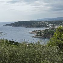
a very challenging route with many variations very beautiful starting with the coastal road, then the climb to Sant Celoni, afterwards rather flat but a lot of traffic!
- -:--
- Duration
- 147.3 km
- Distance
- 801 m
- Ascent
- 801 m
- Descent
- ---
- Avg. speed
- ---
- Max. altitude

Route quality
Waytypes & surfaces along the route
Waytypes
Road
23.6 km
(16 %)
Quiet road
19.1 km
(13 %)
Surfaces
Paved
83.9 km
(57 %)
Unpaved
8.8 km
(6 %)
Asphalt
81 km
(55 %)
Gravel
5.9 km
(4 %)
Route highlights
Points of interest along the route

Point of interest after 0 km
Start und Ziel meiner Zahlreichen Radtouren www.playadearo.de
Continue with Bikemap
Use, edit, or download this cycling route
You would like to ride RR-Strecke: Platja - Caldes d´Estrac-Sant Celoni-Caldes de Malavella-Platja or customize it for your own trip? Here is what you can do with this Bikemap route:
Free features
- Save this route as favorite or in collections
- Copy & plan your own version of this route
- Split it into stages to create a multi-day tour
- Sync your route with Garmin or Wahoo
Premium features
Free trial for 3 days, or one-time payment. More about Bikemap Premium.
- Navigate this route on iOS & Android
- Export a GPX / KML file of this route
- Create your custom printout (try it for free)
- Download this route for offline navigation
Discover more Premium features.
Get Bikemap PremiumFrom our community
Other popular routes starting in Castell-Platja d'Aro
 Voie comme un escargot dans Castell-Platja d'Aro
- Distance
- 51.7 km
- Ascent
- 1,278 m
- Descent
- 1,278 m
- Location
- Castell-Platja d'Aro, Catalonia, Spain
 De Carrer dels Nards, 3, Castell-Platja d'Aro à Carrer dels Nards, 3, Castell-Platja d'Aro
- Distance
- 58.4 km
- Ascent
- 518 m
- Descent
- 552 m
- Location
- Castell-Platja d'Aro, Catalonia, Spain
 Carrer Ginjoler, Castell d'Aro, Platja d'Aro i s'Agaró à Carrer Ginjoler, Castell d'Aro, Platja d'Aro i s'Agaró
- Distance
- 54 km
- Ascent
- 523 m
- Descent
- 525 m
- Location
- Castell-Platja d'Aro, Catalonia, Spain
 Internacional - Aigues Bones
- Distance
- 25.4 km
- Ascent
- 203 m
- Descent
- 105 m
- Location
- Castell-Platja d'Aro, Catalonia, Spain
 RR-Strecke: Platja - Caldes d´Estrac-Sant Celoni-Caldes de Malavella-Platja
- Distance
- 147.3 km
- Ascent
- 801 m
- Descent
- 801 m
- Location
- Castell-Platja d'Aro, Catalonia, Spain
 At Home 2016
- Distance
- 1,611.2 km
- Ascent
- 1,121 m
- Descent
- 1,039 m
- Location
- Castell-Platja d'Aro, Catalonia, Spain
 Calonge(Treumal) St.Pellala Romanya
- Distance
- 73.8 km
- Ascent
- 1,192 m
- Descent
- 1,204 m
- Location
- Castell-Platja d'Aro, Catalonia, Spain
 De Carrer dels Nards, 3, Castell-Platja d'Aro à Carrer de Kaminies, 13, Castell-Platja d'Aro
- Distance
- 47.1 km
- Ascent
- 10 m
- Descent
- 43 m
- Location
- Castell-Platja d'Aro, Catalonia, Spain
Open it in the app