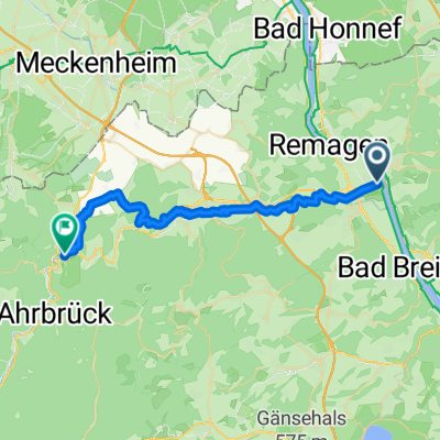
Kripp-Kennedy-Brücke-Linz 54 km
A cycling route starting in Linz am Rhein, Rhineland-Palatinate, Germany.
Overview
About this route
- -:--
- Duration
- 53.4 km
- Distance
- 51 m
- Ascent
- 52 m
- Descent
- ---
- Avg. speed
- ---
- Avg. speed
Route quality
Waytypes & surfaces along the route
Waytypes
Path
18 km
(34 %)
Cycleway
13.1 km
(25 %)
Surfaces
Paved
50.6 km
(95 %)
Unpaved
1.2 km
(2 %)
Asphalt
38.3 km
(72 %)
Paving stones
10 km
(19 %)
Continue with Bikemap
Use, edit, or download this cycling route
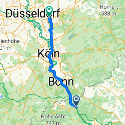
You would like to ride Kripp-Kennedy-Brücke-Linz 54 km or customize it for your own trip? Here is what you can do with this Bikemap route:
Free features
- Save this route as favorite or in collections
- Copy & plan your own version of this route
- Sync your route with Garmin or Wahoo
Premium features
Free trial for 3 days, or one-time payment. More about Bikemap Premium.
- Navigate this route on iOS & Android
- Export a GPX / KML file of this route
- Create your custom printout (try it for free)
- Download this route for offline navigation
Discover more Premium features.
Get Bikemap PremiumFrom our community
Other popular routes starting in Linz am Rhein
- CYCLING THE RHINE: Route 11A
- Distance
- 45.7 km
- Ascent
- 156 m
- Descent
- 143 m
- Location
- Linz am Rhein, Rhineland-Palatinate, Germany
- RR19 - Remagen > Koln
- Distance
- 61.4 km
- Ascent
- 210 m
- Descent
- 228 m
- Location
- Linz am Rhein, Rhineland-Palatinate, Germany
- Kripp - Nürburgring - Brohl-Lützing
- Distance
- 99.5 km
- Ascent
- 776 m
- Descent
- 776 m
- Location
- Linz am Rhein, Rhineland-Palatinate, Germany
- Nürburgringrunde
- Distance
- 98.4 km
- Ascent
- 950 m
- Descent
- 938 m
- Location
- Linz am Rhein, Rhineland-Palatinate, Germany
- End of Summer 2010 (31.10)
- Distance
- 79.5 km
- Ascent
- 783 m
- Descent
- 743 m
- Location
- Linz am Rhein, Rhineland-Palatinate, Germany
- Umleitung Ahr-Radweg Sinzig - Walporzheim
- Distance
- 25.8 km
- Ascent
- 82 m
- Descent
- 21 m
- Location
- Linz am Rhein, Rhineland-Palatinate, Germany
- Kripp-Kennedy-Brücke-Linz 54 km
- Distance
- 53.4 km
- Ascent
- 51 m
- Descent
- 52 m
- Location
- Linz am Rhein, Rhineland-Palatinate, Germany
- Rheinstraße 6, Linz am Rhein nach Bergstraße 115, Königswinter
- Distance
- 17.7 km
- Ascent
- 167 m
- Descent
- 95 m
- Location
- Linz am Rhein, Rhineland-Palatinate, Germany
Open it in the app