
Wanderung - Schwaigrohr-Rundweg
A cycling route starting in Bad Kohlgrub, Bavaria, Germany.
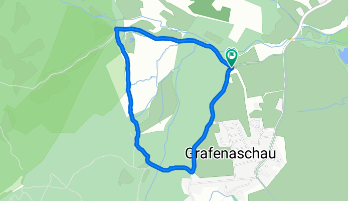
Overview
About this route
This tour takes you through an enchanted forest, past flower meadows to a mountain stream.
- -:--
- Duration
- 3.7 km
- Distance
- 92 m
- Ascent
- 91 m
- Descent
- ---
- Avg. speed
- ---
- Max. altitude
Route quality
Waytypes & surfaces along the route
Waytypes
Track
2.7 km
(72 %)
Path
1 km
(28 %)
Surfaces
Paved
0.1 km
(2 %)
Unpaved
2.7 km
(72 %)
Unpaved (undefined)
1.3 km
(35 %)
Gravel
1 km
(28 %)
Continue with Bikemap
Use, edit, or download this cycling route
You would like to ride Wanderung - Schwaigrohr-Rundweg or customize it for your own trip? Here is what you can do with this Bikemap route:
Free features
- Save this route as favorite or in collections
- Copy & plan your own version of this route
- Sync your route with Garmin or Wahoo
Premium features
Free trial for 3 days, or one-time payment. More about Bikemap Premium.
- Navigate this route on iOS & Android
- Export a GPX / KML file of this route
- Create your custom printout (try it for free)
- Download this route for offline navigation
Discover more Premium features.
Get Bikemap PremiumFrom our community
Other popular routes starting in Bad Kohlgrub
 Bad Kohlgrub, Bad Bayersoejn u. zurück
- Distance
- 6.1 km
- Ascent
- 35 m
- Descent
- 195 m
- Location
- Bad Kohlgrub, Bavaria, Germany
 Bad Kohlgrub - Linderhof
- Distance
- 24.1 km
- Ascent
- 352 m
- Descent
- 249 m
- Location
- Bad Kohlgrub, Bavaria, Germany
 Staffelsee runde
- Distance
- 32.4 km
- Ascent
- 376 m
- Descent
- 376 m
- Location
- Bad Kohlgrub, Bavaria, Germany
 Bad Kohlgrub nach Hopfensee
- Distance
- 43 km
- Ascent
- 437 m
- Descent
- 477 m
- Location
- Bad Kohlgrub, Bavaria, Germany
 Radtour durch Deutschland Teil 25
- Distance
- 70.7 km
- Ascent
- 438 m
- Descent
- 500 m
- Location
- Bad Kohlgrub, Bavaria, Germany
 Schneeschuhwanderung - Stierkopf
- Distance
- 10.3 km
- Ascent
- 446 m
- Descent
- 940 m
- Location
- Bad Kohlgrub, Bavaria, Germany
 Wanderung - Schwaigrohr-Rundweg
- Distance
- 3.7 km
- Ascent
- 92 m
- Descent
- 91 m
- Location
- Bad Kohlgrub, Bavaria, Germany
 Bad Kohlgrub - Wies - Schwabsoien und zurück
- Distance
- 101.2 km
- Ascent
- 586 m
- Descent
- 584 m
- Location
- Bad Kohlgrub, Bavaria, Germany
Open it in the app