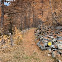
LTH-Plan Praz Ricovero Cap. Sandino-Petosan-LTH
A cycling route starting in La Thuile, Aosta Valley, Italy.
Overview
About this route
Solo
- 1 h 53 min
- Duration
- 13.9 km
- Distance
- 620 m
- Ascent
- 616 m
- Descent
- 7.4 km/h
- Avg. speed
- ---
- Max. altitude
Route photos
Continue with Bikemap
Use, edit, or download this cycling route
You would like to ride LTH-Plan Praz Ricovero Cap. Sandino-Petosan-LTH or customize it for your own trip? Here is what you can do with this Bikemap route:
Free features
- Save this route as favorite or in collections
- Copy & plan your own version of this route
- Sync your route with Garmin or Wahoo
Premium features
Free trial for 3 days, or one-time payment. More about Bikemap Premium.
- Navigate this route on iOS & Android
- Export a GPX / KML file of this route
- Create your custom printout (try it for free)
- Download this route for offline navigation
Discover more Premium features.
Get Bikemap PremiumFrom our community
Other popular routes starting in La Thuile
 LTH-Les Suches-Le Foyer-LTH
- Distance
- 23.4 km
- Ascent
- 857 m
- Descent
- 847 m
- Location
- La Thuile, Aosta Valley, Italy
 LTH-Petosan-Arpy-Colle S. Carlo-LTH
- Distance
- 22.7 km
- Ascent
- 789 m
- Descent
- 785 m
- Location
- La Thuile, Aosta Valley, Italy
 La Thuile - Creta con ciaspole
- Distance
- 8.3 km
- Ascent
- 954 m
- Descent
- 959 m
- Location
- La Thuile, Aosta Valley, Italy
 LTH-Youlaz-Arp-LTH
- Distance
- 26.8 km
- Ascent
- 1,082 m
- Descent
- 1,081 m
- Location
- La Thuile, Aosta Valley, Italy
 9 tappa traversata delle alpi
- Distance
- 136.1 km
- Ascent
- 2,274 m
- Descent
- 3,020 m
- Location
- La Thuile, Aosta Valley, Italy
 Tour de France Etappe 7 La Thuile - Lanslebourg
- Distance
- 101.4 km
- Ascent
- 2,495 m
- Descent
- 2,551 m
- Location
- La Thuile, Aosta Valley, Italy
 LTH-Mont Chaz Dura-Piccolo S. Bernardo-LTH
- Distance
- 30.5 km
- Ascent
- 1,072 m
- Descent
- 1,081 m
- Location
- La Thuile, Aosta Valley, Italy
 Col du Petit Saint-Bernard, Kl. St. Bernhard
- Distance
- 40.2 km
- Ascent
- 749 m
- Descent
- 1,303 m
- Location
- La Thuile, Aosta Valley, Italy
Open it in the app


