

Bartodzieje - Czarnolas - szlak rowerowy
A cycling route starting in Gmina Jedlińsk, Masovian Voivodeship, Poland.
Overview
About this route
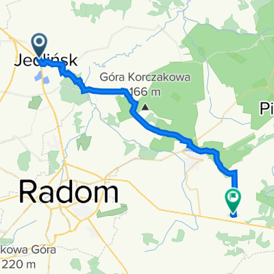
Czerwony szlak rowerowy z Bartodziej do Czarnolasu
- -:--
- Duration
- 52.8 km
- Distance
- 294 m
- Ascent
- 263 m
- Descent
- ---
- Avg. speed
- ---
- Avg. speed

Route quality
Waytypes & surfaces along the route
Waytypes
Track
19.6 km
(37 %)
Road
17.9 km
(34 %)
Surfaces
Paved
22.6 km
(43 %)
Unpaved
10.8 km
(20 %)
Asphalt
18.8 km
(36 %)
Ground
5.4 km
(10 %)
Continue with Bikemap
Use, edit, or download this cycling route
You would like to ride Bartodzieje - Czarnolas - szlak rowerowy or customize it for your own trip? Here is what you can do with this Bikemap route:
Free features
- Save this route as favorite or in collections
- Copy & plan your own version of this route
- Sync your route with Garmin or Wahoo
Premium features
Free trial for 3 days, or one-time payment. More about Bikemap Premium.
- Navigate this route on iOS & Android
- Export a GPX / KML file of this route
- Create your custom printout (try it for free)
- Download this route for offline navigation
Discover more Premium features.
Get Bikemap PremiumFrom our community
Other popular routes starting in Gmina Jedlińsk
 powrót z Jedlińska
- Distance
- 29.4 km
- Ascent
- 116 m
- Descent
- 75 m
- Location
- Gmina Jedlińsk, Masovian Voivodeship, Poland
 Mijanka Radomia
- Distance
- 13.7 km
- Ascent
- 65 m
- Descent
- 55 m
- Location
- Gmina Jedlińsk, Masovian Voivodeship, Poland
 JU DRAJW MI KREJZE
- Distance
- 120.9 km
- Ascent
- 238 m
- Descent
- 236 m
- Location
- Gmina Jedlińsk, Masovian Voivodeship, Poland
 wsola (las,wielo,rdm,firlej,(sklep), s7,)
- Distance
- 13.5 km
- Ascent
- 94 m
- Descent
- 97 m
- Location
- Gmina Jedlińsk, Masovian Voivodeship, Poland
 trasa
trasa- Distance
- 127.3 km
- Ascent
- 134 m
- Descent
- 190 m
- Location
- Gmina Jedlińsk, Masovian Voivodeship, Poland
 Bartodzieje - Czarnolas - szlak rowerowy
- Distance
- 52.8 km
- Ascent
- 294 m
- Descent
- 263 m
- Location
- Gmina Jedlińsk, Masovian Voivodeship, Poland
 Piaseczno 35B, Jedlińsk do Piaseczno 35B, Jedlińsk
- Distance
- 4.5 km
- Ascent
- 12 m
- Descent
- 12 m
- Location
- Gmina Jedlińsk, Masovian Voivodeship, Poland
 Kalinowa 7, Wsola do Kalinowa 9, Wsola
- Distance
- 22.7 km
- Ascent
- 87 m
- Descent
- 83 m
- Location
- Gmina Jedlińsk, Masovian Voivodeship, Poland
Open it in the app