


Bergzeifahren Thüringen Trainingslager
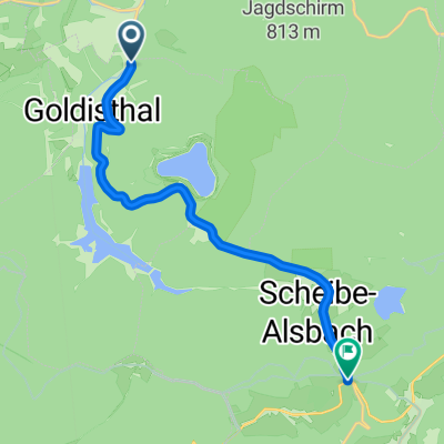
A cycling route starting in Goldisthal, Thuringia, Germany.
Overview
About this route
0
KSV and Chemie determine the timing and the route, the Grünauer mostly only trailed behind
- -:--
- Duration
- 9.8 km
- Distance
- 434 m
- Ascent
- 209 m
- Descent
- ---
- Avg. speed
- 815 m
- Max. altitude
skurt
created this 18 years ago
Route quality
Waytypes & surfaces along the route
Waytypes
Quiet road
0.3 km
3 %
Access road
0.2 km
2 %
Undefined
9.3 km
95 %
Surfaces
Paved
3 km
(31 %)
Asphalt
3 km
31 %
Undefined
6.8 km
69 %
Continue with Bikemap
Use, edit, or download this cycling route
You would like to ride Bergzeifahren Thüringen Trainingslager or customize it for your own trip? Here is what you can do with this Bikemap route:
Free features
- Save this route as favorite or in collections
- Copy & plan your own version of this route
- Sync your route with Garmin or Wahoo
Premium features
Free trial for 3 days, or one-time payment. More about Bikemap Premium.
- Navigate this route on iOS & Android
- Export a GPX / KML file of this route
- Create your custom printout (try it for free)
- Download this route for offline navigation
Discover more Premium features.
Get Bikemap PremiumFrom our community
Other popular routes starting in Goldisthal


 Rennsteigstraße 23, Eisfeld nach Landsberger Straße, Meiningen0
- 68.5 km
- 427 m
- 925 m
- Goldisthal, Thuringia, Germany


Open it in the app