

Anello di Savigliano,dalla pianura alle alpi del giro d'italia
A cycling route starting in Savigliano, Piedmont, Italy.
Overview
About this route
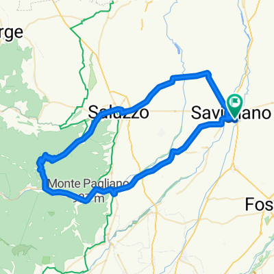
Departure from Savigliano, a town in the Cuneo plain with about 21000 inhabitants. It is recommended to arrive by car (A6 Turin-Savona, exit Marene-Cherasco) or by train (line Turin-Cuneo-Savona, stop Savigliano). Cycling loop of approximately 120 km with an elevation gain of about 2200 meters (Cima Coppi, Colle Sampeyre m.2289). Recommended season: May 15 - October 15. Suitable for touring cyclists trained in long climbs.
- -:--
- Duration
- 111.6 km
- Distance
- 2,666 m
- Ascent
- 2,672 m
- Descent
- ---
- Avg. speed
- ---
- Max. altitude
Continue with Bikemap
Use, edit, or download this cycling route
You would like to ride Anello di Savigliano,dalla pianura alle alpi del giro d'italia or customize it for your own trip? Here is what you can do with this Bikemap route:
Free features
- Save this route as favorite or in collections
- Copy & plan your own version of this route
- Split it into stages to create a multi-day tour
- Sync your route with Garmin or Wahoo
Premium features
Free trial for 3 days, or one-time payment. More about Bikemap Premium.
- Navigate this route on iOS & Android
- Export a GPX / KML file of this route
- Create your custom printout (try it for free)
- Download this route for offline navigation
Discover more Premium features.
Get Bikemap PremiumFrom our community
Other popular routes starting in Savigliano
 Giro de Italia 2010 (4 Etape)
- Distance
- 32 km
- Ascent
- 194 m
- Descent
- 0 m
- Location
- Savigliano, Piedmont, Italy
 BR2018 - TAPPA 2 - 23 Giugno
- Distance
- 19.9 km
- Ascent
- 44 m
- Descent
- 27 m
- Location
- Savigliano, Piedmont, Italy
 pianura di savigliano
- Distance
- 47 km
- Ascent
- 146 m
- Descent
- 91 m
- Location
- Savigliano, Piedmont, Italy
 Salita di Brondello
- Distance
- 66.4 km
- Ascent
- 544 m
- Descent
- 542 m
- Location
- Savigliano, Piedmont, Italy
 12 Grandabici: Savigliano - Cuneo
- Distance
- 38.5 km
- Ascent
- 243 m
- Descent
- 23 m
- Location
- Savigliano, Piedmont, Italy
 Savigliano - Lemma - Savigliano
- Distance
- 73.7 km
- Ascent
- 688 m
- Descent
- 686 m
- Location
- Savigliano, Piedmont, Italy
 Anello di Savigliano,dalla pianura alle alpi del giro d'italia
- Distance
- 111.6 km
- Ascent
- 2,666 m
- Descent
- 2,672 m
- Location
- Savigliano, Piedmont, Italy
 Savigliano - Busca
- Distance
- 60.3 km
- Ascent
- 212 m
- Descent
- 212 m
- Location
- Savigliano, Piedmont, Italy
Open it in the app