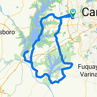
635 Finnbar Dr, Cary to 580–598 Finnbar Dr, Cary
A cycling route starting in Green Level, North Carolina, United States of America.
Overview
About this route
- 44 min
- Duration
- 6.5 km
- Distance
- 195 m
- Ascent
- 190 m
- Descent
- 8.9 km/h
- Avg. speed
- ---
- Avg. speed
Route quality
Waytypes & surfaces along the route
Waytypes
Cycleway
5.3 km
(82 %)
Quiet road
0.7 km
(11 %)
Surfaces
Paved
5.3 km
(80 %)
Unpaved
0.9 km
(14 %)
Asphalt
5.1 km
(78 %)
Ground
0.9 km
(14 %)
Continue with Bikemap
Use, edit, or download this cycling route
You would like to ride 635 Finnbar Dr, Cary to 580–598 Finnbar Dr, Cary or customize it for your own trip? Here is what you can do with this Bikemap route:
Free features
- Save this route as favorite or in collections
- Copy & plan your own version of this route
- Sync your route with Garmin or Wahoo
Premium features
Free trial for 3 days, or one-time payment. More about Bikemap Premium.
- Navigate this route on iOS & Android
- Export a GPX / KML file of this route
- Create your custom printout (try it for free)
- Download this route for offline navigation
Discover more Premium features.
Get Bikemap PremiumFrom our community
Other popular routes starting in Green Level
- 635 Finnbar Dr, Cary to 580–598 Finnbar Dr, Cary
- Distance
- 6.5 km
- Ascent
- 195 m
- Descent
- 190 m
- Location
- Green Level, North Carolina, United States of America
- 56 New Hope
- Distance
- 90.6 km
- Ascent
- 314 m
- Descent
- 313 m
- Location
- Green Level, North Carolina, United States of America
- Frogger- Cary edition
- Distance
- 19.9 km
- Ascent
- 88 m
- Descent
- 88 m
- Location
- Green Level, North Carolina, United States of America
- 45-mile route from Western Cary through Jordan Lake dam
- Distance
- 85.6 km
- Ascent
- 226 m
- Descent
- 222 m
- Location
- Green Level, North Carolina, United States of America
- 100-mile Siler City lunch
- Distance
- 153.2 km
- Ascent
- 351 m
- Descent
- 352 m
- Location
- Green Level, North Carolina, United States of America
- f1xedgear's commute route
- Distance
- 33.8 km
- Ascent
- 129 m
- Descent
- 145 m
- Location
- Green Level, North Carolina, United States of America
- 50ml route around Jordan Lake
- Distance
- 80.9 km
- Ascent
- 257 m
- Descent
- 256 m
- Location
- Green Level, North Carolina, United States of America
- 57-mile route around Jordan Lake, then dam and Tobacco trail
- Distance
- 99.1 km
- Ascent
- 383 m
- Descent
- 384 m
- Location
- Green Level, North Carolina, United States of America
Open it in the app