

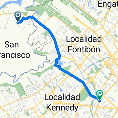
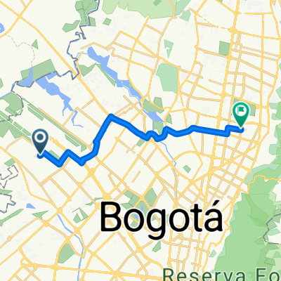
De Bogotá-Alto de El vino
A cycling route starting in Funza, Cundinamarca, Colombia.
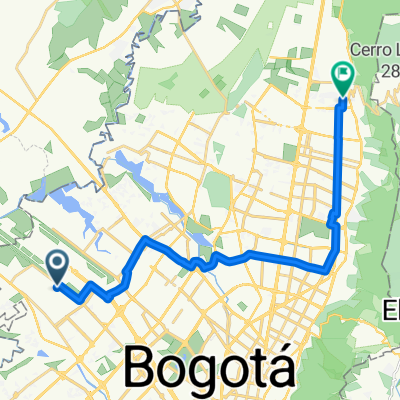
Overview
About this route
- 2 h 21 min
- Duration
- 45.7 km
- Distance
- 991 m
- Ascent
- 991 m
- Descent
- 19.4 km/h
- Avg. speed
- ---
- Max. altitude

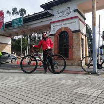
Route photos

Continue with Bikemap
Use, edit, or download this cycling route
You would like to ride De Bogotá-Alto de El vino or customize it for your own trip? Here is what you can do with this Bikemap route:
Free features
- Save this route as favorite or in collections
- Copy & plan your own version of this route
- Sync your route with Garmin or Wahoo
Premium features
Free trial for 3 days, or one-time payment. More about Bikemap Premium.
- Navigate this route on iOS & Android
- Export a GPX / KML file of this route
- Create your custom printout (try it for free)
- Download this route for offline navigation
Discover more Premium features.
Get Bikemap PremiumFrom our community
Other popular routes starting in Funza
 De Carrera # 2-22 a Avenida 9-771
- Distance
- 12.1 km
- Ascent
- 36 m
- Descent
- 23 m
- Location
- Funza, Cundinamarca, Colombia
 Apto-Fonti-Unicentro-Norte
- Distance
- 16.1 km
- Ascent
- 44 m
- Descent
- 37 m
- Location
- Funza, Cundinamarca, Colombia
 Zipaquirá Cundinamarca
- Distance
- 95.6 km
- Ascent
- 503 m
- Descent
- 488 m
- Location
- Funza, Cundinamarca, Colombia
 Fontibon-Mondoñedo-Tequendama
- Distance
- 108.7 km
- Ascent
- 1,449 m
- Descent
- 1,449 m
- Location
- Funza, Cundinamarca, Colombia
 De Calle 14 23-31, Funza a Subachoque - La Pradera
- Distance
- 29.6 km
- Ascent
- 381 m
- Descent
- 239 m
- Location
- Funza, Cundinamarca, Colombia
 De KR - AV. Centenario a AV. Centenario - KR
- Distance
- 4.4 km
- Ascent
- 118 m
- Descent
- 131 m
- Location
- Funza, Cundinamarca, Colombia
 De Calle 12 20-13, Funza a Calle 12 20-13, Funza
- Distance
- 33.9 km
- Ascent
- 204 m
- Descent
- 201 m
- Location
- Funza, Cundinamarca, Colombia
 Apto-Fonti-Calle 116-Nova-Torre
- Distance
- 24.8 km
- Ascent
- 55 m
- Descent
- 46 m
- Location
- Funza, Cundinamarca, Colombia
Open it in the app