

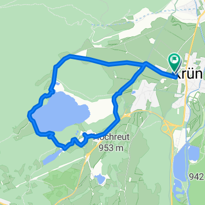
Krün-okolo Walchensee-Krün
A cycling route starting in Krün, Bavaria, Germany.
Overview
About this route
- -:--
- Duration
- 54.7 km
- Distance
- 429 m
- Ascent
- 427 m
- Descent
- ---
- Avg. speed
- ---
- Max. altitude

Continue with Bikemap
Use, edit, or download this cycling route
You would like to ride Krün-okolo Walchensee-Krün or customize it for your own trip? Here is what you can do with this Bikemap route:
Free features
- Save this route as favorite or in collections
- Copy & plan your own version of this route
- Sync your route with Garmin or Wahoo
Premium features
Free trial for 3 days, or one-time payment. More about Bikemap Premium.
- Navigate this route on iOS & Android
- Export a GPX / KML file of this route
- Create your custom printout (try it for free)
- Download this route for offline navigation
Discover more Premium features.
Get Bikemap PremiumFrom our community
Other popular routes starting in Krün
 Rund um die Soierngruppe
- Distance
- 49.1 km
- Ascent
- 874 m
- Descent
- 874 m
- Location
- Krün, Bavaria, Germany
 Kranzberg-Gipfel – Schloss Elmau Runde von Klais
- Distance
- 29.1 km
- Ascent
- 913 m
- Descent
- 910 m
- Location
- Krün, Bavaria, Germany
 Rundweg Krün - Fischbachalm
- Distance
- 34.6 km
- Ascent
- 1,249 m
- Descent
- 1,091 m
- Location
- Krün, Bavaria, Germany
 An der Isar entlang Klais - Bad Tölz
- Distance
- 55.5 km
- Ascent
- 402 m
- Descent
- 650 m
- Location
- Krün, Bavaria, Germany
 Gerold - Wörgl 94 km
- Distance
- 93.6 km
- Ascent
- 1,120 m
- Descent
- 1,527 m
- Location
- Krün, Bavaria, Germany
 Krottenkopfstraße 14, Krün nach Krottenkopfstraße 16, Krün
- Distance
- 9 km
- Ascent
- 193 m
- Descent
- 193 m
- Location
- Krün, Bavaria, Germany
 Krün-okolo Walchensee-Krün
- Distance
- 54.7 km
- Ascent
- 429 m
- Descent
- 427 m
- Location
- Krün, Bavaria, Germany
 Ferchenseerunde via Garmisch
- Distance
- 37 km
- Ascent
- 640 m
- Descent
- 639 m
- Location
- Krün, Bavaria, Germany
Open it in the app