

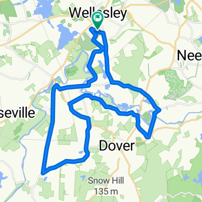
8km Route
A cycling route starting in Wellesley, Massachusetts, United States.
Overview
About this route
- -:--
- Duration
- 7.9 km
- Distance
- 57 m
- Ascent
- 55 m
- Descent
- ---
- Avg. speed
- ---
- Max. altitude

Route quality
Waytypes & surfaces along the route
Waytypes
Quiet road
6.9 km
(87 %)
Road
0.7 km
(9 %)
Undefined
0.3 km
(4 %)
Surfaces
Paved
4.7 km
(60 %)
Unpaved
0.2 km
(2 %)
Asphalt
4.7 km
(60 %)
Unpaved (undefined)
0.2 km
(2 %)
Undefined
3 km
(38 %)
Continue with Bikemap
Use, edit, or download this cycling route
You would like to ride 8km Route or customize it for your own trip? Here is what you can do with this Bikemap route:
Free features
- Save this route as favorite or in collections
- Copy & plan your own version of this route
- Sync your route with Garmin or Wahoo
Premium features
Free trial for 3 days, or one-time payment. More about Bikemap Premium.
- Navigate this route on iOS & Android
- Export a GPX / KML file of this route
- Create your custom printout (try it for free)
- Download this route for offline navigation
Discover more Premium features.
Get Bikemap PremiumFrom our community
Other popular routes starting in Wellesley
 Powisset 30 Mile
- Distance
- 52.4 km
- Ascent
- 270 m
- Descent
- 272 m
- Location
- Wellesley, Massachusetts, United States
 50 mi Wstn Wlnd Sdbry Frm Dvr Mdfld Ndhm
- Distance
- 81.3 km
- Ascent
- 239 m
- Descent
- 239 m
- Location
- Wellesley, Massachusetts, United States
 Dover Run
- Distance
- 24.4 km
- Ascent
- 177 m
- Descent
- 177 m
- Location
- Wellesley, Massachusetts, United States
 Wellesley to Bourne
- Distance
- 136.6 km
- Ascent
- 661 m
- Descent
- 710 m
- Location
- Wellesley, Massachusetts, United States
 Weston 12,8K
- Distance
- 12.9 km
- Ascent
- 129 m
- Descent
- 129 m
- Location
- Wellesley, Massachusetts, United States
 8km Route
- Distance
- 7.9 km
- Ascent
- 57 m
- Descent
- 55 m
- Location
- Wellesley, Massachusetts, United States
 Lake Cochituate Loop
- Distance
- 23.3 km
- Ascent
- 111 m
- Descent
- 110 m
- Location
- Wellesley, Massachusetts, United States
 Rivers Radcliffe Blueberry
- Distance
- 10 km
- Ascent
- 57 m
- Descent
- 60 m
- Location
- Wellesley, Massachusetts, United States
Open it in the app