

Coronado - Lindora - Coronado
A cycling route starting in Ipís, Provincia de San José, Costa Rica.
Overview
About this route
Iglesia de Coronado - Escazú via Calle Vieja - Lindora - Belén - Heredia - Santo Domingo - Tibás - Coronado
- -:--
- Duration
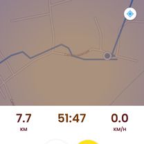
- 58.8 km
- Distance
- 871 m
- Ascent
- 871 m
- Descent
- ---
- Avg. speed
- ---
- Max. altitude

Route quality
Waytypes & surfaces along the route
Waytypes
Quiet road
12.9 km
(22 %)
Access road
3.5 km
(6 %)
Surfaces
Paved
54.1 km
(92 %)
Asphalt
49.4 km
(84 %)
Concrete
4.1 km
(7 %)
Continue with Bikemap
Use, edit, or download this cycling route
You would like to ride Coronado - Lindora - Coronado or customize it for your own trip? Here is what you can do with this Bikemap route:
Free features
- Save this route as favorite or in collections
- Copy & plan your own version of this route
- Sync your route with Garmin or Wahoo
Premium features
Free trial for 3 days, or one-time payment. More about Bikemap Premium.
- Navigate this route on iOS & Android
- Export a GPX / KML file of this route
- Create your custom printout (try it for free)
- Download this route for offline navigation
Discover more Premium features.
Get Bikemap PremiumFrom our community
Other popular routes starting in Ipís
 cascajal
- Distance
- 15.5 km
- Ascent
- 389 m
- Descent
- 487 m
- Location
- Ipís, Provincia de San José, Costa Rica
 De Calle Guadalupe, Vásquez de Coronado a Vía 307, Moravia
- Distance
- 1,801.4 km
- Ascent
- 2,441 m
- Descent
- 2,791 m
- Location
- Ipís, Provincia de San José, Costa Rica
 Ruta de descanso
- Distance
- 16.5 km
- Ascent
- 681 m
- Descent
- 710 m
- Location
- Ipís, Provincia de San José, Costa Rica
 Copa el Reto Coronado
- Distance
- 32 km
- Ascent
- 960 m
- Descent
- 957 m
- Location
- Ipís, Provincia de San José, Costa Rica
 Las nubes 2
- Distance
- 18.3 km
- Ascent
- 489 m
- Descent
- 489 m
- Location
- Ipís, Provincia de San José, Costa Rica
 Coronado - Lindora - Coronado
- Distance
- 58.8 km
- Ascent
- 871 m
- Descent
- 871 m
- Location
- Ipís, Provincia de San José, Costa Rica
 Subida a Rancho Redondo
- Distance
- 7.4 km
- Ascent
- 581 m
- Descent
- 0 m
- Location
- Ipís, Provincia de San José, Costa Rica
 Las Nubes a pegar con Pared y vic
- Distance
- 26.1 km
- Ascent
- 484 m
- Descent
- 484 m
- Location
- Ipís, Provincia de San José, Costa Rica
Open it in the app