

Három Tó - Három játszótér túra - avagy Kamaraerdő kicsit másképp
A cycling route starting in Újbuda, Budapest, Hungary.
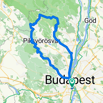
Overview
About this route
- -:--
- Duration
- 11 km
- Distance
- 62 m
- Ascent
- 48 m
- Descent
- ---
- Avg. speed
- ---
- Max. altitude

Route quality
Waytypes & surfaces along the route
Waytypes
Quiet road
4.3 km
(39 %)
Living street
2 km
(18 %)
Surfaces
Paved
8.1 km
(74 %)
Unpaved
0.8 km
(7 %)
Asphalt
8 km
(73 %)
Gravel
0.8 km
(7 %)
Continue with Bikemap
Use, edit, or download this cycling route
You would like to ride Három Tó - Három játszótér túra - avagy Kamaraerdő kicsit másképp or customize it for your own trip? Here is what you can do with this Bikemap route:
Free features
- Save this route as favorite or in collections
- Copy & plan your own version of this route
- Sync your route with Garmin or Wahoo
Premium features
Free trial for 3 days, or one-time payment. More about Bikemap Premium.
- Navigate this route on iOS & Android
- Export a GPX / KML file of this route
- Create your custom printout (try it for free)
- Download this route for offline navigation
Discover more Premium features.
Get Bikemap PremiumFrom our community
Other popular routes starting in Újbuda
 Budapest - Balatonfenyves
- Distance
- 161.9 km
- Ascent
- 419 m
- Descent
- 420 m
- Location
- Újbuda, Budapest, Hungary
 Budapest - Balatonfenyves (BuBa+Balatonkör)
- Distance
- 190.1 km
- Ascent
- 883 m
- Descent
- 879 m
- Location
- Újbuda, Budapest, Hungary
 Gazdagrét - Peron Büfé
- Distance
- 17.6 km
- Ascent
- 137 m
- Descent
- 99 m
- Location
- Újbuda, Budapest, Hungary
 Budapest to Szentendre
- Distance
- 78 km
- Ascent
- 868 m
- Descent
- 867 m
- Location
- Újbuda, Budapest, Hungary
 Kis budai kör
- Distance
- 21.8 km
- Ascent
- 312 m
- Descent
- 312 m
- Location
- Újbuda, Budapest, Hungary
 Kopaszigát - Érd - Diósd - Törökbálint - Kopaszigát
- Distance
- 48.2 km
- Ascent
- 257 m
- Descent
- 261 m
- Location
- Újbuda, Budapest, Hungary
 Csepel-sziget végig
- Distance
- 122 km
- Ascent
- 53 m
- Descent
- 53 m
- Location
- Újbuda, Budapest, Hungary
 csillaghegy-rókahegy-csobánka-lajosforrás-fagyoskatona-pilisszentkereszt-piros-nagykovácsi-hűvösvölgy
- Distance
- 81.1 km
- Ascent
- 1,159 m
- Descent
- 1,160 m
- Location
- Újbuda, Budapest, Hungary
Open it in the app