

064 panamericana
A cycling route starting in Cihuatlán, Jalisco, Mexico.
Overview
About this route
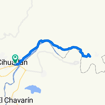
cihuatlan-manzanillo-el colomo-ciudad de armeria-colonia bayardo-tecoman-cerro de ortega-cayaca
- -:--
- Duration
- 148.9 km
- Distance
- 306 m
- Ascent
- 325 m
- Descent
- ---
- Avg. speed
- ---
- Avg. speed
Continue with Bikemap
Use, edit, or download this cycling route
You would like to ride 064 panamericana or customize it for your own trip? Here is what you can do with this Bikemap route:
Free features
- Save this route as favorite or in collections
- Copy & plan your own version of this route
- Sync your route with Garmin or Wahoo
Premium features
Free trial for 3 days, or one-time payment. More about Bikemap Premium.
- Navigate this route on iOS & Android
- Export a GPX / KML file of this route
- Create your custom printout (try it for free)
- Download this route for offline navigation
Discover more Premium features.
Get Bikemap PremiumFrom our community
Other popular routes starting in Cihuatlán
 cihuatlan aeropuerto playa de oro
- Distance
- 23.2 km
- Ascent
- 632 m
- Descent
- 645 m
- Location
- Cihuatlán, Jalisco, Mexico
 cihuatlan /ojo de agua
- Distance
- 35.8 km
- Ascent
- 790 m
- Descent
- 775 m
- Location
- Cihuatlán, Jalisco, Mexico
 cihuatlán tequesquitlan
- Distance
- 25.2 km
- Ascent
- 1,683 m
- Descent
- 1,237 m
- Location
- Cihuatlán, Jalisco, Mexico
 064 panamericana
- Distance
- 148.9 km
- Ascent
- 306 m
- Descent
- 325 m
- Location
- Cihuatlán, Jalisco, Mexico
 Cihuatlán la Peña
- Distance
- 25 km
- Ascent
- 1,479 m
- Descent
- 1,476 m
- Location
- Cihuatlán, Jalisco, Mexico
 cihuatlan camino tequesquitlan
- Distance
- 9 km
- Ascent
- 650 m
- Descent
- 640 m
- Location
- Cihuatlán, Jalisco, Mexico
 cihuatlán la peña
- Distance
- 24.2 km
- Ascent
- 772 m
- Descent
- 777 m
- Location
- Cihuatlán, Jalisco, Mexico
 camino a tequesqui
- Distance
- 8 km
- Ascent
- 668 m
- Descent
- 658 m
- Location
- Cihuatlán, Jalisco, Mexico
Open it in the app