

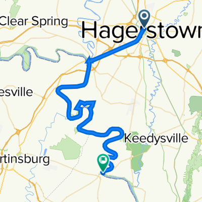
Hagerstown - Washington DC
A cycling route starting in Hagerstown, Maryland, United States of America.
Overview
About this route
From downtown Hagerstwon to the Mall in Washington DC
As a practical option I would turn right before the Beltway onto Eggert Dr and head down to the river for the C&O Canal towpath -- unpaved as it seems but a doable way to avoid the heavier traffic into town -- trail ends near the Kenned Center if I'm not mistaken
- -:--
- Duration
- 121.9 km
- Distance
- 494 m
- Ascent
- 649 m
- Descent
- ---
- Avg. speed
- ---
- Avg. speed
Continue with Bikemap
Use, edit, or download this cycling route
You would like to ride Hagerstown - Washington DC or customize it for your own trip? Here is what you can do with this Bikemap route:
Free features
- Save this route as favorite or in collections
- Copy & plan your own version of this route
- Sync your route with Garmin or Wahoo
Premium features
Free trial for 3 days, or one-time payment. More about Bikemap Premium.
- Navigate this route on iOS & Android
- Export a GPX / KML file of this route
- Create your custom printout (try it for free)
- Download this route for offline navigation
Discover more Premium features.
Get Bikemap PremiumFrom our community
Other popular routes starting in Hagerstown
 Easy ride in Hagerstown
- Distance
- 0.1 km
- Ascent
- 0 m
- Descent
- 0 m
- Location
- Hagerstown, Maryland, United States of America
 Recovered Route
- Distance
- 58.8 km
- Ascent
- 588 m
- Descent
- 671 m
- Location
- Hagerstown, Maryland, United States of America
 Hagerstown, MD - Oakland, MD
- Distance
- 214.6 km
- Ascent
- 1,495 m
- Descent
- 947 m
- Location
- Hagerstown, Maryland, United States of America
 473–487 Liberty St, Hagerstown to 11825 Newgate Blvd, Hagerstown
- Distance
- 9.6 km
- Ascent
- 68 m
- Descent
- 80 m
- Location
- Hagerstown, Maryland, United States of America
 North Cleveland Avenue 351, Hagerstown to North Cleveland Avenue 351, Hagerstown
- Distance
- 17.5 km
- Ascent
- 193 m
- Descent
- 189 m
- Location
- Hagerstown, Maryland, United States of America
 East Baltimore Street 32, Hagerstown to National Pike 101, Clear Spring
- Distance
- 23.2 km
- Ascent
- 309 m
- Descent
- 289 m
- Location
- Hagerstown, Maryland, United States of America
 Hagerstown - Washington DC
- Distance
- 121.9 km
- Ascent
- 494 m
- Descent
- 649 m
- Location
- Hagerstown, Maryland, United States of America
 736 Maryland Ave, Hagerstown to 736 Maryland Ave, Hagerstown
- Distance
- 4.3 km
- Ascent
- 126 m
- Descent
- 174 m
- Location
- Hagerstown, Maryland, United States of America
Open it in the app