

Ribnjaci - Golo Brdo
A cycling route starting in Virovitica, Virovitica-Podravina County, Croatia.
Overview
About this route
Bike trail Virovitički ribnjaci - Golo Brdo
- -:--
- Duration
- 12.6 km
- Distance
- 179 m
- Ascent
- 161 m
- Descent
- ---
- Avg. speed
- ---
- Max. altitude
Route highlights
Points of interest along the route

Photo after 0 km
Početak biciklističke staze

Photo after 3 km
skrenite desno

Photo after 3.2 km
skrenite desno

Photo after 4.1 km
skrenite lijevo

Photo after 5.4 km
početak uspona

Photo after 7.5 km
Izlazak iz šume. Skrenite desno

Photo after 9.7 km
Skrenite desno prema Golom Brdu

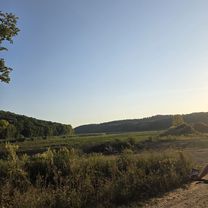
Point of interest after 12.5 km
Continue with Bikemap
Use, edit, or download this cycling route
You would like to ride Ribnjaci - Golo Brdo or customize it for your own trip? Here is what you can do with this Bikemap route:
Free features
- Save this route as favorite or in collections
- Copy & plan your own version of this route
- Sync your route with Garmin or Wahoo
Premium features
Free trial for 3 days, or one-time payment. More about Bikemap Premium.
- Navigate this route on iOS & Android
- Export a GPX / KML file of this route
- Create your custom printout (try it for free)
- Download this route for offline navigation
Discover more Premium features.
Get Bikemap PremiumFrom our community
Other popular routes starting in Virovitica
 10. nap (Barcs - Brinjani)
- Distance
- 82 km
- Ascent
- 308 m
- Descent
- 246 m
- Location
- Virovitica, Virovitica-Podravina County, Croatia
 Bilogorska to Bilogorska
- Distance
- 20.3 km
- Ascent
- 197 m
- Descent
- 243 m
- Location
- Virovitica, Virovitica-Podravina County, Croatia
 grand 100+
- Distance
- 110.8 km
- Ascent
- 317 m
- Descent
- 319 m
- Location
- Virovitica, Virovitica-Podravina County, Croatia
 Afternoon Trail Run
- Distance
- 7.1 km
- Ascent
- 203 m
- Descent
- 208 m
- Location
- Virovitica, Virovitica-Podravina County, Croatia
 Virovitica - Ribnjaci - Virovitica
- Distance
- 21.5 km
- Ascent
- 166 m
- Descent
- 163 m
- Location
- Virovitica, Virovitica-Podravina County, Croatia
 Bilogorom u blizini Trnave
- Distance
- 41.6 km
- Ascent
- 236 m
- Descent
- 236 m
- Location
- Virovitica, Virovitica-Podravina County, Croatia
 Kapela Dvor - Rit
- Distance
- 4.9 km
- Ascent
- 0 m
- Descent
- 0 m
- Location
- Virovitica, Virovitica-Podravina County, Croatia
 4Drava2016
- Distance
- 72.8 km
- Ascent
- 19 m
- Descent
- 64 m
- Location
- Virovitica, Virovitica-Podravina County, Croatia
Open it in the app