


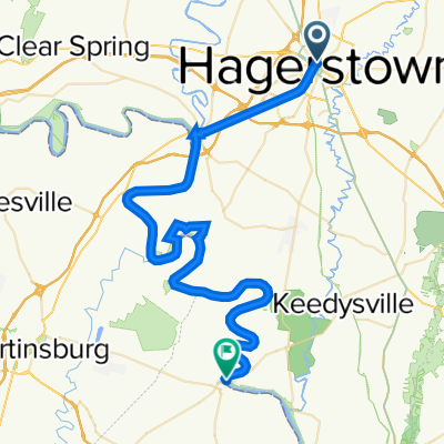
Stoystown to Hagerstown
A cycling route starting in Hagerstown, Maryland, United States.
Overview
About this route
0
150 km with a lot of climbing -- several steep parts, 3 major ridges
about 2500 m of climbing
route mostly follows US 30
- -:--
- Duration
- 149.3 km
- Distance
- 1,837 m
- Ascent
- 1,410 m
- Descent
- ---
- Avg. speed
- ---
- Max. altitude
rhein228
created this 15 years ago
Continue with Bikemap
Use, edit, or download this cycling route
You would like to ride Stoystown to Hagerstown or customize it for your own trip? Here is what you can do with this Bikemap route:
Free features
- Save this route as favorite or in collections
- Copy & plan your own version of this route
- Split it into stages to create a multi-day tour
- Sync your route with Garmin or Wahoo
Premium features
Free trial for 3 days, or one-time payment. More about Bikemap Premium.
- Navigate this route on iOS & Android
- Export a GPX / KML file of this route
- Create your custom printout (try it for free)
- Download this route for offline navigation
Discover more Premium features.
Get Bikemap PremiumFrom our community
Other popular routes starting in Hagerstown
 473–487 Liberty St, Hagerstown to 11825 Newgate Blvd, Hagerstown0
- 9.6 km
- 68 m
- 80 m
- Hagerstown, Maryland, United States
 North Cleveland Avenue 351, Hagerstown to Garland Groh Boulevard 17794, Hagerstown0
- 24.2 km
- 145 m
- 100 m
- Hagerstown, Maryland, United States

 De East Antietam Street 33, Hagerstown a West Memorial Boulevard 501, Hagerstown0
- 1.1 km
- 0 m
- 0 m
- Hagerstown, Maryland, United States
 North Cleveland Avenue 351, Hagerstown to North Cleveland Avenue 351, Hagerstown2
- 17.5 km
- 193 m
- 189 m
- Hagerstown, Maryland, United States
 East Baltimore Street 32, Hagerstown to National Pike 101, Clear Spring0
- 23.2 km
- 309 m
- 289 m
- Hagerstown, Maryland, United States
 736 Maryland Ave, Hagerstown to 736 Maryland Ave, Hagerstown0
- 4.3 km
- 126 m
- 174 m
- Hagerstown, Maryland, United States


Open it in the app