

Von der Pram zum Inn und zurück
A cycling route starting in Ried im Innkreis, Upper Austria, Austria.
Overview
About this route
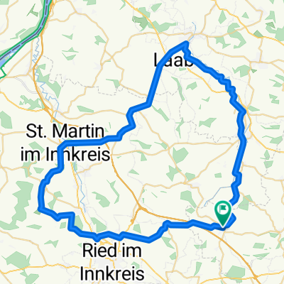
From Pram (Hausruckviertel) via Ried i.I. (Innviertel) and the spa town Geinberg to the Inn - along the Inn to Obernberg and back to Hausruckviertel via Ort i.I. (Osternach Bach). The route runs 80 % on secondary roads - some short connecting sections lead onto federal roads (higher traffic only during peak hours). Ascents at Geiersberg and Kramern - otherwise slightly hilly to very flat.
- -:--
- Duration
- 78.5 km
- Distance
- 527 m
- Ascent
- 508 m
- Descent
- ---
- Avg. speed
- 560 m
- Max. altitude
Route quality
Waytypes & surfaces along the route
Waytypes
Quiet road
18.8 km
(24 %)
Road
10.2 km
(13 %)
Surfaces
Paved
19.6 km
(25 %)
Asphalt
19.6 km
(25 %)
Undefined
58.9 km
(75 %)
Continue with Bikemap
Use, edit, or download this cycling route
You would like to ride Von der Pram zum Inn und zurück or customize it for your own trip? Here is what you can do with this Bikemap route:
Free features
- Save this route as favorite or in collections
- Copy & plan your own version of this route
- Sync your route with Garmin or Wahoo
Premium features
Free trial for 3 days, or one-time payment. More about Bikemap Premium.
- Navigate this route on iOS & Android
- Export a GPX / KML file of this route
- Create your custom printout (try it for free)
- Download this route for offline navigation
Discover more Premium features.
Get Bikemap PremiumFrom our community
Other popular routes starting in Ried im Innkreis
 Hausrucktour 1
- Distance
- 57.4 km
- Ascent
- 527 m
- Descent
- 530 m
- Location
- Ried im Innkreis, Upper Austria, Austria
 Pram - Taufkirchen an der Trattnach - Zell an der Pram. 🚴♂️🚴
- Distance
- 47 km
- Ascent
- 866 m
- Descent
- 864 m
- Location
- Ried im Innkreis, Upper Austria, Austria
 Pramtalrunde
- Distance
- 59.6 km
- Ascent
- 416 m
- Descent
- 403 m
- Location
- Ried im Innkreis, Upper Austria, Austria
 Von der Pram zum Inn und zurück
- Distance
- 78.5 km
- Ascent
- 527 m
- Descent
- 508 m
- Location
- Ried im Innkreis, Upper Austria, Austria
 Ried - Wildenau
- Distance
- 14.7 km
- Ascent
- 204 m
- Descent
- 229 m
- Location
- Ried im Innkreis, Upper Austria, Austria
 Noxberg - Extended
- Distance
- 31.8 km
- Ascent
- 360 m
- Descent
- 360 m
- Location
- Ried im Innkreis, Upper Austria, Austria
 Umrundung von Ried im Innkreis
- Distance
- 57.7 km
- Ascent
- 560 m
- Descent
- 561 m
- Location
- Ried im Innkreis, Upper Austria, Austria
 Ried im Innkreis - Marienweg / Luisenhöhe
- Distance
- 39.4 km
- Ascent
- 522 m
- Descent
- 519 m
- Location
- Ried im Innkreis, Upper Austria, Austria
Open it in the app