

Tour zum Völlaner Joch
A cycling route starting in Lana, Trentino-Alto Adige, Italy.
Overview
About this route
Anspruchsvolle Tour mit sehr technischen und schwierigen Downhillabschnitten. Nur für professionelle Mountainbiker!
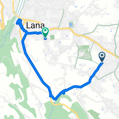
Diese Tour startet direkt in unserem malerischen Dörfchen Völlan. Vom Hotel als Ausgangspunkt, geht es die Hauptstraße bergauf und vorbei an der Dorfkirche. Nun links abbiegen und der Markeriung 4 folgend zuerst auf Straße bis zu den Gallhöfen, dann in gleichbleibender Steigung auf Schotter bergauf. Vorbei an der Jägehütte (unbewirtschaftet) unter Kreuz- und Jochberg entlang fährt man zum Völlaner Joch (1.640m). Retour führt der Weg dann am Außerberg vorbei, Markierung Nr. 10, steil bis nach Platzers und von dort über den Weg mit der Nr. 7 bis nach Oberhauser. Danach wird der Weg, der zurück bis in die Ortschaft Völlan führt ordentlich steil, herrlich für alle Liebhaber von anspruchsvollen Trails.
- 2 h 7 min
- Duration
- 19.7 km
- Distance
- 994 m
- Ascent
- 1,006 m
- Descent
- 9.3 km/h
- Avg. speed
- ---
- Max. altitude

Route quality
Waytypes & surfaces along the route
Waytypes
Track
11.1 km
(56 %)
Quiet road
5.8 km
(29 %)
Surfaces
Paved
1.2 km
(6 %)
Unpaved
10 km
(51 %)
Gravel
6.5 km
(33 %)
Ground
3.3 km
(17 %)
Continue with Bikemap
Use, edit, or download this cycling route
You would like to ride Tour zum Völlaner Joch or customize it for your own trip? Here is what you can do with this Bikemap route:
Free features
- Save this route as favorite or in collections
- Copy & plan your own version of this route
- Sync your route with Garmin or Wahoo
Premium features
Free trial for 3 days, or one-time payment. More about Bikemap Premium.
- Navigate this route on iOS & Android
- Export a GPX / KML file of this route
- Create your custom printout (try it for free)
- Download this route for offline navigation
Discover more Premium features.
Get Bikemap PremiumFrom our community
Other popular routes starting in Lana
 Lanaer Seitenblicke
- Distance
- 26.2 km
- Ascent
- 767 m
- Descent
- 766 m
- Location
- Lana, Trentino-Alto Adige, Italy
 Lana, Tesimo, Nalles, Lana 26.3Km 450Hm
- Distance
- 26.3 km
- Ascent
- 433 m
- Descent
- 434 m
- Location
- Lana, Trentino-Alto Adige, Italy
 Lana Siegmundskron
- Distance
- 59.8 km
- Ascent
- 223 m
- Descent
- 217 m
- Location
- Lana, Trentino-Alto Adige, Italy
 I 008: Überetsch
- Distance
- 43.4 km
- Ascent
- 191 m
- Descent
- 190 m
- Location
- Lana, Trentino-Alto Adige, Italy
 Mayenburgstraße 32, Völlan nach Mayenburgstraße 32, Völlan
- Distance
- 19.3 km
- Ascent
- 1,596 m
- Descent
- 1,601 m
- Location
- Lana, Trentino-Alto Adige, Italy
 Goldeggstraße, Lana nach Kapuzinerstraße, Lana
- Distance
- 2.4 km
- Ascent
- 91 m
- Descent
- 70 m
- Location
- Lana, Trentino-Alto Adige, Italy
 Lana - Meran - Lana
- Distance
- 40.1 km
- Ascent
- 392 m
- Descent
- 394 m
- Location
- Lana, Trentino-Alto Adige, Italy
 I_31_R_Lana-Meran-Lana
- Distance
- 33.9 km
- Ascent
- 212 m
- Descent
- 214 m
- Location
- Lana, Trentino-Alto Adige, Italy
Open it in the app