

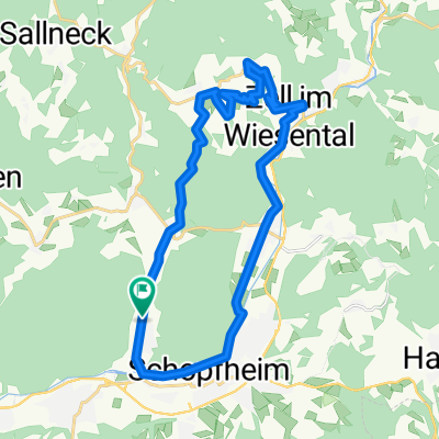
Erdmannshöhle und Eichener See
A cycling route starting in Schopfheim, Baden-Wurttemberg, Germany.
Overview
About this route
The travel time for this tour is about 4 hours. This route is very suitable for experienced cyclists. Start and finish are both at the marketplace in Schopfheim. Attractions include the Erdmann cave and the Eichener Lake.
- -:--
- Duration
- 27.1 km
- Distance
- 454 m
- Ascent
- 454 m
- Descent
- ---
- Avg. speed
- ---
- Max. altitude
Route quality
Waytypes & surfaces along the route
Waytypes
Quiet road
10.9 km
(40 %)
Track
8.4 km
(31 %)
Surfaces
Paved
23.6 km
(87 %)
Unpaved
2.2 km
(8 %)
Asphalt
23.1 km
(85 %)
Gravel
2.2 km
(8 %)
Continue with Bikemap
Use, edit, or download this cycling route
You would like to ride Erdmannshöhle und Eichener See or customize it for your own trip? Here is what you can do with this Bikemap route:
Free features
- Save this route as favorite or in collections
- Copy & plan your own version of this route
- Sync your route with Garmin or Wahoo
Premium features
Free trial for 3 days, or one-time payment. More about Bikemap Premium.
- Navigate this route on iOS & Android
- Export a GPX / KML file of this route
- Create your custom printout (try it for free)
- Download this route for offline navigation
Discover more Premium features.
Get Bikemap PremiumFrom our community
Other popular routes starting in Schopfheim
 Friedrichstraße 9, Schopfheim nach Friedrichstraße 7, Schopfheim
- Distance
- 15.4 km
- Ascent
- 162 m
- Descent
- 152 m
- Location
- Schopfheim, Baden-Wurttemberg, Germany
 Erdmannshöhle und Eichener See
- Distance
- 27.1 km
- Ascent
- 454 m
- Descent
- 454 m
- Location
- Schopfheim, Baden-Wurttemberg, Germany
 Die Höhlentour
- Distance
- 21.6 km
- Ascent
- 384 m
- Descent
- 384 m
- Location
- Schopfheim, Baden-Wurttemberg, Germany
 Hohe Flum
- Distance
- 18.2 km
- Ascent
- 265 m
- Descent
- 263 m
- Location
- Schopfheim, Baden-Wurttemberg, Germany
 Blünimattstraße 9A, Schopfheim nach Blünimattstraße 9A, Schopfheim
- Distance
- 24.9 km
- Ascent
- 554 m
- Descent
- 556 m
- Location
- Schopfheim, Baden-Wurttemberg, Germany
 SchopfheimerHöhenMeterRundfahrt
- Distance
- 82.8 km
- Ascent
- 1,704 m
- Descent
- 1,458 m
- Location
- Schopfheim, Baden-Wurttemberg, Germany
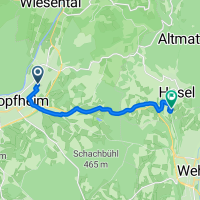 Blasistraße, Schopfheim nach Wehrer Straße, Hasel
- Distance
- 7.3 km
- Ascent
- 136 m
- Descent
- 122 m
- Location
- Schopfheim, Baden-Wurttemberg, Germany
 Schopfheim - Schlächtenhaus - Hauingen - Schopfheim
- Distance
- 36.9 km
- Ascent
- 490 m
- Descent
- 488 m
- Location
- Schopfheim, Baden-Wurttemberg, Germany
Open it in the app