
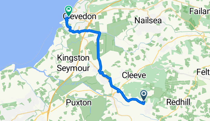
Route from Pixieland, West Hay Road, Bristol
A cycling route starting in Wrington, England, United Kingdom.
Overview
About this route
- 1 h
- Duration
- 14.5 km
- Distance
- 41 m
- Ascent
- 81 m
- Descent
- 14.6 km/h
- Avg. speed
- ---
- Max. altitude
Route quality
Waytypes & surfaces along the route
Waytypes
Quiet road
11 km
(76 %)
Pedestrian area
1 km
(7 %)
Surfaces
Paved
6.5 km
(45 %)
Unpaved
0.1 km
(1 %)
Asphalt
6 km
(41 %)
Paved (undefined)
0.3 km
(2 %)
Continue with Bikemap
Use, edit, or download this cycling route
You would like to ride Route from Pixieland, West Hay Road, Bristol or customize it for your own trip? Here is what you can do with this Bikemap route:
Free features
- Save this route as favorite or in collections
- Copy & plan your own version of this route
- Sync your route with Garmin or Wahoo
Premium features
Free trial for 3 days, or one-time payment. More about Bikemap Premium.
- Navigate this route on iOS & Android
- Export a GPX / KML file of this route
- Create your custom printout (try it for free)
- Download this route for offline navigation
Discover more Premium features.
Get Bikemap PremiumFrom our community
Other popular routes starting in Wrington
 High Street 4, Wrington to South Side 31, Congresbury
- Distance
- 3.9 km
- Ascent
- 68 m
- Descent
- 25 m
- Location
- Wrington, England, United Kingdom
 18 Rickyard Road, Bristol to Hill Road, Winscombe
- Distance
- 7.8 km
- Ascent
- 30 m
- Descent
- 30 m
- Location
- Wrington, England, United Kingdom
 Route from Pixieland, West Hay Road, Bristol
- Distance
- 14.5 km
- Ascent
- 41 m
- Descent
- 81 m
- Location
- Wrington, England, United Kingdom
 Wrington Mendip Evening Blast
- Distance
- 19.7 km
- Ascent
- 317 m
- Descent
- 317 m
- Location
- Wrington, England, United Kingdom
 De Cowslip Green à Frome
- Distance
- 41.3 km
- Ascent
- 457 m
- Descent
- 384 m
- Location
- Wrington, England, United Kingdom
Open it in the app