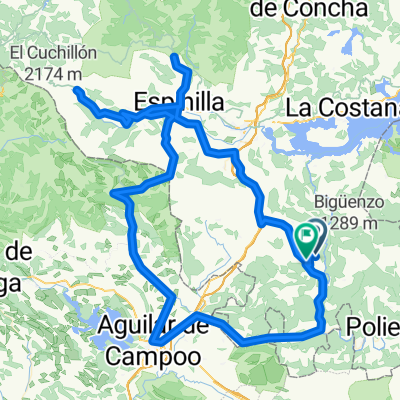
110611 - Acampada en estrella desde Reinosa
A cycling route starting in Mataporquera, Cantabria, Spain.
Overview
About this route
A star camping will be organized from Reinosa in this roughly marked area. Suggestions are welcome, such as:
- Climbing to Tres Mares,
- Going down the Saja and visiting Bárcena Mayor,...
- -:--
- Duration
- 114.2 km
- Distance
- 4,595 m
- Ascent
- 4,605 m
- Descent
- ---
- Avg. speed
- ---
- Max. altitude
Continue with Bikemap
Use, edit, or download this cycling route
You would like to ride 110611 - Acampada en estrella desde Reinosa or customize it for your own trip? Here is what you can do with this Bikemap route:
Free features
- Save this route as favorite or in collections
- Copy & plan your own version of this route
- Split it into stages to create a multi-day tour
- Sync your route with Garmin or Wahoo
Premium features
Free trial for 3 days, or one-time payment. More about Bikemap Premium.
- Navigate this route on iOS & Android
- Export a GPX / KML file of this route
- Create your custom printout (try it for free)
- Download this route for offline navigation
Discover more Premium features.
Get Bikemap PremiumFrom our community
Other popular routes starting in Mataporquera
- Mataporquera-Bardal-Barruelo
- Distance
- 64 km
- Ascent
- 703 m
- Descent
- 695 m
- Location
- Mataporquera, Cantabria, Spain
- Mataporquera-Bardal-Pozazal
- Distance
- 32.5 km
- Ascent
- 435 m
- Descent
- 423 m
- Location
- Mataporquera, Cantabria, Spain
- Mataporquera-Olea
- Distance
- 18.2 km
- Ascent
- 187 m
- Descent
- 182 m
- Location
- Mataporquera, Cantabria, Spain
- ruta del ebro completa
- Distance
- 920.8 km
- Ascent
- 9,740 m
- Descent
- 10,683 m
- Location
- Mataporquera, Cantabria, Spain
- Mataporquera-Barruelo-Mataporquera
- Distance
- 43 km
- Ascent
- 578 m
- Descent
- 583 m
- Location
- Mataporquera, Cantabria, Spain
- La Trasncantabrica
- Distance
- 162.6 km
- Ascent
- 1,673 m
- Descent
- 1,674 m
- Location
- Mataporquera, Cantabria, Spain
- 110611 - Acampada en estrella desde Reinosa
- Distance
- 114.2 km
- Ascent
- 4,595 m
- Descent
- 4,605 m
- Location
- Mataporquera, Cantabria, Spain
- arroyo polientes
- Distance
- 90.4 km
- Ascent
- 787 m
- Descent
- 782 m
- Location
- Mataporquera, Cantabria, Spain
Open it in the app