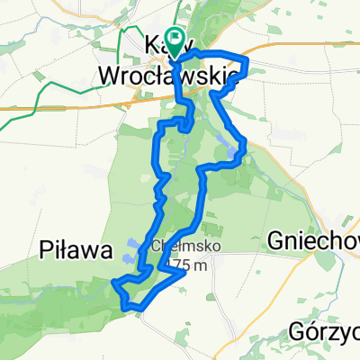
CX Kąty - Las Ratyński - Kąty
A cycling route starting in Kąty Wrocławskie, Lower Silesian Voivodeship, Poland.
Overview
About this route
- -:--
- Duration
- 61.6 km
- Distance
- 102 m
- Ascent
- 108 m
- Descent
- ---
- Avg. speed
- ---
- Max. altitude
Route quality
Waytypes & surfaces along the route
Waytypes
Track
32.7 km
(53 %)
Quiet road
11.7 km
(19 %)
Surfaces
Paved
11.7 km
(19 %)
Unpaved
13.6 km
(22 %)
Asphalt
11.1 km
(18 %)
Ground
5.5 km
(9 %)
Route highlights
Points of interest along the route
Point of interest after 0 km
Continue with Bikemap
Use, edit, or download this cycling route
You would like to ride CX Kąty - Las Ratyński - Kąty or customize it for your own trip? Here is what you can do with this Bikemap route:
Free features
- Save this route as favorite or in collections
- Copy & plan your own version of this route
- Sync your route with Garmin or Wahoo
Premium features
Free trial for 3 days, or one-time payment. More about Bikemap Premium.
- Navigate this route on iOS & Android
- Export a GPX / KML file of this route
- Create your custom printout (try it for free)
- Download this route for offline navigation
Discover more Premium features.
Get Bikemap PremiumFrom our community
Other popular routes starting in Kąty Wrocławskie
- Dolina Bystrzycy
- Distance
- 45.5 km
- Ascent
- 80 m
- Descent
- 80 m
- Location
- Kąty Wrocławskie, Lower Silesian Voivodeship, Poland
- Pętla Kąty Wrocławskie - Sobótka - Tąpadła - Pożarzysko - Kąty Wrocławskie
- Distance
- 87.8 km
- Ascent
- 319 m
- Descent
- 320 m
- Location
- Kąty Wrocławskie, Lower Silesian Voivodeship, Poland
- Kąty - Świdnica - Kąty - Świdnica
- Distance
- 53.9 km
- Ascent
- 633 m
- Descent
- 525 m
- Location
- Kąty Wrocławskie, Lower Silesian Voivodeship, Poland
- CX Kąty - Las Ratyński - Kąty
- Distance
- 61.6 km
- Ascent
- 102 m
- Descent
- 108 m
- Location
- Kąty Wrocławskie, Lower Silesian Voivodeship, Poland
- Gruszkowy Ciechan - na pierożki do Sobótki
- Distance
- 41 km
- Ascent
- 314 m
- Descent
- 314 m
- Location
- Kąty Wrocławskie, Lower Silesian Voivodeship, Poland
- Kąty Wrocławskie Pętla Bielika
- Distance
- 22.9 km
- Ascent
- 123 m
- Descent
- 124 m
- Location
- Kąty Wrocławskie, Lower Silesian Voivodeship, Poland
- Dolina Bystrzycy
- Distance
- 47.3 km
- Ascent
- 184 m
- Descent
- 186 m
- Location
- Kąty Wrocławskie, Lower Silesian Voivodeship, Poland
- Kąty - Płonica R9
- Distance
- 95.8 km
- Ascent
- 609 m
- Descent
- 498 m
- Location
- Kąty Wrocławskie, Lower Silesian Voivodeship, Poland
Open it in the app