

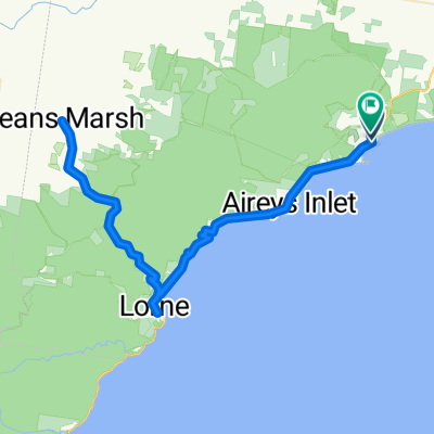
Niblick Street 21, Anglesea to Niblick Street 40, Anglesea
A cycling route starting in Anglesea, Victoria, Australia.
Overview
About this route
- 1 h 42 min
- Duration
- 31.2 km
- Distance
- 337 m
- Ascent
- 327 m
- Descent
- 18.4 km/h
- Avg. speed
- ---
- Max. altitude
Route quality
Waytypes & surfaces along the route
Waytypes
Busy road
19 km
(61 %)
Quiet road
12.1 km
(39 %)
Surfaces
Paved
23.1 km
(74 %)
Unpaved
3.3 km
(11 %)
Asphalt
20.5 km
(66 %)
Gravel
3.3 km
(11 %)
Continue with Bikemap
Use, edit, or download this cycling route
You would like to ride Niblick Street 21, Anglesea to Niblick Street 40, Anglesea or customize it for your own trip? Here is what you can do with this Bikemap route:
Free features
- Save this route as favorite or in collections
- Copy & plan your own version of this route
- Sync your route with Garmin or Wahoo
Premium features
Free trial for 3 days, or one-time payment. More about Bikemap Premium.
- Navigate this route on iOS & Android
- Export a GPX / KML file of this route
- Create your custom printout (try it for free)
- Download this route for offline navigation
Discover more Premium features.
Get Bikemap PremiumFrom our community
Other popular routes starting in Anglesea
 Anglesea trails
- Distance
- 64 km
- Ascent
- 731 m
- Descent
- 736 m
- Location
- Anglesea, Victoria, Australia
 Easy ride in Anglesea
- Distance
- 12.1 km
- Ascent
- 103 m
- Descent
- 104 m
- Location
- Anglesea, Victoria, Australia
 Easy ride in Anglesea
- Distance
- 12.1 km
- Ascent
- 77 m
- Descent
- 77 m
- Location
- Anglesea, Victoria, Australia
 Moderate route in Bells Beach
- Distance
- 15.2 km
- Ascent
- 106 m
- Descent
- 106 m
- Location
- Anglesea, Victoria, Australia
 Great Ocean Road
- Distance
- 148.4 km
- Ascent
- 799 m
- Descent
- 772 m
- Location
- Anglesea, Victoria, Australia
 Niblick Street 21, Anglesea to Niblick Street 40, Anglesea
- Distance
- 31.2 km
- Ascent
- 337 m
- Descent
- 327 m
- Location
- Anglesea, Victoria, Australia
 CX Tour of the Eastern Otways
- Distance
- 108.4 km
- Ascent
- 1,046 m
- Descent
- 1,046 m
- Location
- Anglesea, Victoria, Australia
 Anglesea, Lorne, Deans Marsh, Anglesea
- Distance
- 101.4 km
- Ascent
- 1,083 m
- Descent
- 1,088 m
- Location
- Anglesea, Victoria, Australia
Open it in the app