

Von Mannheim zum Apfelblütenweg
A cycling route starting in Altrip, Rhineland-Palatinate, Germany.
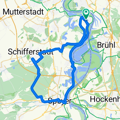
Overview
About this route
Teilweise Straße, viele Rennrad geeignete Wirtschaftswege bis zum Odenwald. Dann bis ca. 10% Steigungen. Am Ende des Apfelblütenwegs ein Brunnen mit Trinkwasser. Die Belohnung: Ewig lange Abfahrt bis Schriesheim.
- -:--
- Duration
- 55.6 km
- Distance
- 472 m
- Ascent
- 475 m
- Descent
- ---
- Avg. speed
- 418 m
- Avg. speed
Route quality
Waytypes & surfaces along the route
Waytypes
Quiet road
15.5 km
(28 %)
Road
13.1 km
(24 %)
Surfaces
Paved
53.3 km
(96 %)
Asphalt
47.1 km
(85 %)
Paving stones
4.5 km
(8 %)
Continue with Bikemap
Use, edit, or download this cycling route
You would like to ride Von Mannheim zum Apfelblütenweg or customize it for your own trip? Here is what you can do with this Bikemap route:
Free features
- Save this route as favorite or in collections
- Copy & plan your own version of this route
- Sync your route with Garmin or Wahoo
Premium features
Free trial for 3 days, or one-time payment. More about Bikemap Premium.
- Navigate this route on iOS & Android
- Export a GPX / KML file of this route
- Create your custom printout (try it for free)
- Download this route for offline navigation
Discover more Premium features.
Get Bikemap PremiumFrom our community
Other popular routes starting in Altrip
 Königsstuhl - Wilhelmsfeld - Langenthal - Rothenberg - Rippenweier
- Distance
- 111.4 km
- Ascent
- 1,574 m
- Descent
- 1,576 m
- Location
- Altrip, Rhineland-Palatinate, Germany
 Altrip-Schifferstadt-Haßloch-Geinsheim-Dudenhofen-Speyer-Altrip CLONED FROM ROUTE 262025
- Distance
- 62.4 km
- Ascent
- 67 m
- Descent
- 68 m
- Location
- Altrip, Rhineland-Palatinate, Germany
 Altrip-Speyer-Dudenhofen-Waldsee-Altrip CLONED FROM ROUTE 21934
- Distance
- 44.3 km
- Ascent
- 50 m
- Descent
- 50 m
- Location
- Altrip, Rhineland-Palatinate, Germany
 Weißer Stein - Langenthal - Rothenberg - Rippenweier
- Distance
- 97.3 km
- Ascent
- 1,755 m
- Descent
- 1,755 m
- Location
- Altrip, Rhineland-Palatinate, Germany
 Nach Neustadt
- Distance
- 94.2 km
- Ascent
- 317 m
- Descent
- 313 m
- Location
- Altrip, Rhineland-Palatinate, Germany
 Neckarauer Straße 17, Mannheim nach Fischerstraße 48, Mannheim
- Distance
- 20.8 km
- Ascent
- 57 m
- Descent
- 57 m
- Location
- Altrip, Rhineland-Palatinate, Germany
 Mannheim - Lampertheim
- Distance
- 41 km
- Ascent
- 37 m
- Descent
- 39 m
- Location
- Altrip, Rhineland-Palatinate, Germany
 Mannheim-Neckarau nach Mannheim-Fanklin und zurück
- Distance
- 29.4 km
- Ascent
- 174 m
- Descent
- 174 m
- Location
- Altrip, Rhineland-Palatinate, Germany
Open it in the app