


164 panamericana
A cycling route starting in La Junta, Aysén, Chile.
Overview
About this route
1
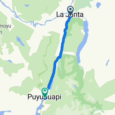
posada near rio palena-lago risopatron-puerto puyuguapi-canal poyouguapi-posada near laguna las torres
- -:--
- Duration
- 131.7 km
- Distance
- 1,206 m
- Ascent
- 949 m
- Descent
- ---
- Avg. speed
- ---
- Max. altitude
tpx
created this 15 years ago
Route quality
Waytypes & surfaces along the route
Waytypes
Cycleway
126.4 km
96 %
Road
2.6 km
2 %
Surfaces
Paved
73.8 km
(56 %)
Unpaved
54 km
(41 %)
Asphalt
46.1 km
35 %
Unpaved (undefined)
35.6 km
27 %
Continue with Bikemap
Use, edit, or download this cycling route
You would like to ride 164 panamericana or customize it for your own trip? Here is what you can do with this Bikemap route:
Free features
- Save this route as favorite or in collections
- Copy & plan your own version of this route
- Split it into stages to create a multi-day tour
- Sync your route with Garmin or Wahoo
Premium features
Free trial for 3 days, or one-time payment. More about Bikemap Premium.
- Navigate this route on iOS & Android
- Export a GPX / KML file of this route
- Create your custom printout (try it for free)
- Download this route for offline navigation
Discover more Premium features.
Get Bikemap PremiumFrom our community
Other popular routes starting in La Junta


 9. La Junta to Puyuhuapi and Cisnes and Queulat National Park0
- 140.4 km
- 3,596 m
- 3,591 m
- La Junta, Aysén, Chile


Open it in the app