

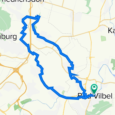
Danka_ImM_N_via neben A661, F-Bogen
A cycling route starting in Bad Vilbel, Hesse, Germany.
Overview
About this route
Danka_ImM_N_via neben A661, F-Bogen
- -:--
- Duration
- 6.2 km
- Distance
- 68 m
- Ascent
- 20 m
- Descent
- ---
- Avg. speed
- ---
- Max. altitude

Continue with Bikemap
Use, edit, or download this cycling route
You would like to ride Danka_ImM_N_via neben A661, F-Bogen or customize it for your own trip? Here is what you can do with this Bikemap route:
Free features
- Save this route as favorite or in collections
- Copy & plan your own version of this route
- Sync your route with Garmin or Wahoo
Premium features
Free trial for 3 days, or one-time payment. More about Bikemap Premium.
- Navigate this route on iOS & Android
- Export a GPX / KML file of this route
- Create your custom printout (try it for free)
- Download this route for offline navigation
Discover more Premium features.
Get Bikemap PremiumFrom our community
Other popular routes starting in Bad Vilbel
 RTF Niedererlenbach 114km Runde
- Distance
- 116 km
- Ascent
- 940 m
- Descent
- 928 m
- Location
- Bad Vilbel, Hesse, Germany
 Grüngürtel
- Distance
- 64.6 km
- Ascent
- 219 m
- Descent
- 212 m
- Location
- Bad Vilbel, Hesse, Germany
 Büdinger-Runde M (RB 091-0450)
- Distance
- 93.1 km
- Ascent
- 314 m
- Descent
- 313 m
- Location
- Bad Vilbel, Hesse, Germany
 Rundkurs ab Enkheim
- Distance
- 47.8 km
- Ascent
- 278 m
- Descent
- 285 m
- Location
- Bad Vilbel, Hesse, Germany
 Ronneburgrunde - ca. 550 Hm
- Distance
- 87.9 km
- Ascent
- 596 m
- Descent
- 564 m
- Location
- Bad Vilbel, Hesse, Germany
 Ronneburgrunde südlich (RB 073 - 0340)
- Distance
- 73.2 km
- Ascent
- 321 m
- Descent
- 321 m
- Location
- Bad Vilbel, Hesse, Germany
 Eschbach-Erlenbach
- Distance
- 26.8 km
- Ascent
- 92 m
- Descent
- 91 m
- Location
- Bad Vilbel, Hesse, Germany
 Lange Radrunde durch Frankfurt am Main
- Distance
- 49.1 km
- Ascent
- 294 m
- Descent
- 288 m
- Location
- Bad Vilbel, Hesse, Germany
Open it in the app