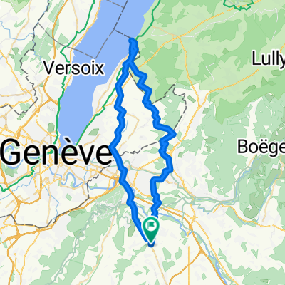
VTT Rocailles
A cycling route starting in Reignier-脡sery, Auvergne-Rh么ne-Alpes, France.
Overview
About this route
- -:--
- Duration
- 8.4 km
- Distance
- 77 m
- Ascent
- 78 m
- Descent
- ---
- Avg. speed
- ---
- Avg. speed
Route quality
Waytypes & surfaces along the route
Waytypes
Track
4.9 km
(58 %)
Path
2.4 km
(29 %)
Surfaces
Paved
0.2 km
(2 %)
Unpaved
4.4 km
(52 %)
Gravel
2.7 km
(32 %)
Unpaved (undefined)
1.2 km
(14 %)
Continue with Bikemap
Use, edit, or download this cycling route
You would like to ride VTT Rocailles or customize it for your own trip? Here is what you can do with this Bikemap route:
Free features
- Save this route as favorite or in collections
- Copy & plan your own version of this route
- Sync your route with Garmin or Wahoo
Premium features
Free trial for 3 days, or one-time payment. More about Bikemap Premium.
- Navigate this route on iOS & Android
- Export a GPX / KML file of this route
- Create your custom printout (try it for free)
- Download this route for offline navigation
Discover more Premium features.
Get Bikemap PremiumFrom our community
Other popular routes starting in Reignier-脡sery
- La Grande Automnale
- Distance
- 182.5 km
- Ascent
- 3,294 m
- Descent
- 2,316 m
- Location
- Reignier-脡sery, Auvergne-Rh么ne-Alpes, France
- La Grande Automnale 2018
- Distance
- 202.7 km
- Ascent
- 4,059 m
- Descent
- 3,044 m
- Location
- Reignier-脡sery, Auvergne-Rh么ne-Alpes, France
- VTT Rocailles
- Distance
- 8.4 km
- Ascent
- 77 m
- Descent
- 78 m
- Location
- Reignier-脡sery, Auvergne-Rh么ne-Alpes, France
- reignier
- Distance
- 5.1 km
- Ascent
- 250 m
- Descent
- 50 m
- Location
- Reignier-脡sery, Auvergne-Rh么ne-Alpes, France
- La Grande Automnale 2019
- Distance
- 152 km
- Ascent
- 3,801 m
- Descent
- 2,871 m
- Location
- Reignier-脡sery, Auvergne-Rh么ne-Alpes, France
- 1988 - Tour de France - 03. Tag - L'Eculaz - Montm茅lian
- Distance
- 126.2 km
- Ascent
- 774 m
- Descent
- 931 m
- Location
- Reignier-脡sery, Auvergne-Rh么ne-Alpes, France
- 08/12/2022
- Distance
- 8.3 km
- Ascent
- 34 m
- Descent
- 35 m
- Location
- Reignier-脡sery, Auvergne-Rh么ne-Alpes, France
- RECO Croix-Fry/ Gli猫res
- Distance
- 137.1 km
- Ascent
- 2,454 m
- Descent
- 2,454 m
- Location
- Reignier-脡sery, Auvergne-Rh么ne-Alpes, France
Open it in the app