

Banijsko pogorje
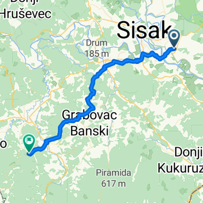
A cycling route starting in Budaševo, Sisak-Moslavina County, Croatia.
Overview
About this route
A special feature of this route is that it passes by the speleological site 'Gradusa'. The existence of this cave has long been known, but it was only speleologically explored in 2004. A total of 455 meters of passages were discovered, most of which end in water, which is considered not to be the cave’s final end. A large colony of bats lives in the cave, and on larger occasions they can be seen flying out.
Besides this site, the route passes through villages devastated by war, with war traces still very visible today. The villages are abandoned, houses partly ruined, and the population sparse.
This route is not overly demanding, but it is strenuous due to the continuous up and down terrain. The roads are mostly gravel, and the length of the route is 38.5 km. Riding time is about 3.5 hours. Along the way there are several shops where supplies can be replenished, so it is not necessary to carry large amounts of water.
- -:--
- Duration
- 38.7 km
- Distance
- 390 m
- Ascent
- 390 m
- Descent
- ---
- Avg. speed
- ---
- Max. altitude

Route highlights
Points of interest along the route
Point of interest after 38.7 km
Continue with Bikemap
Use, edit, or download this cycling route
You would like to ride Banijsko pogorje or customize it for your own trip? Here is what you can do with this Bikemap route:
Free features
- Save this route as favorite or in collections
- Copy & plan your own version of this route
- Sync your route with Garmin or Wahoo
Premium features
Free trial for 3 days, or one-time payment. More about Bikemap Premium.
- Navigate this route on iOS & Android
- Export a GPX / KML file of this route
- Create your custom printout (try it for free)
- Download this route for offline navigation
Discover more Premium features.
Get Bikemap PremiumFrom our community
Other popular routes starting in Budaševo
 Banijsko pogorje
- Distance
- 38.7 km
- Ascent
- 485 m
- Descent
- 487 m
- Location
- Budaševo, Sisak-Moslavina County, Croatia
 Banijsko pogorje
- Distance
- 38.7 km
- Ascent
- 390 m
- Descent
- 390 m
- Location
- Budaševo, Sisak-Moslavina County, Croatia
 Sunja 56
- Distance
- 56.4 km
- Ascent
- 97 m
- Descent
- 95 m
- Location
- Budaševo, Sisak-Moslavina County, Croatia
 Budaševo - Glina
- Distance
- 49 km
- Ascent
- 483 m
- Descent
- 430 m
- Location
- Budaševo, Sisak-Moslavina County, Croatia
 Savska ruta BPŽ (trenutna eurovelo trasa)
- Distance
- 105.4 km
- Ascent
- 95 m
- Descent
- 60 m
- Location
- Budaševo, Sisak-Moslavina County, Croatia
 Ljubljanica 3, Martinska Ves to Staatsbrücke, Salzburg
- Distance
- 469.4 km
- Ascent
- 4,487 m
- Descent
- 4,157 m
- Location
- Budaševo, Sisak-Moslavina County, Croatia
 Lonjsko polje
- Distance
- 123.1 km
- Ascent
- 55 m
- Descent
- 57 m
- Location
- Budaševo, Sisak-Moslavina County, Croatia
 Ostrvo 32, Topolovac to Hofweg 1, Sankt Thomas
- Distance
- 263.9 km
- Ascent
- 5,837 m
- Descent
- 5,472 m
- Location
- Budaševo, Sisak-Moslavina County, Croatia
Open it in the app