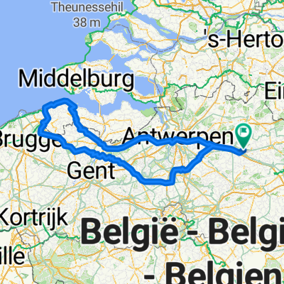
de zotte 300
A cycling route starting in Olen, Flemish Region, Belgium.
Overview
About this route
- -:--
- Duration
- 312 km
- Distance
- 40 m
- Ascent
- 39 m
- Descent
- ---
- Avg. speed
- ---
- Avg. speed
Route quality
Waytypes & surfaces along the route
Waytypes
Cycleway
116.3 km
(37 %)
Quiet road
107 km
(34 %)
Surfaces
Paved
167.6 km
(54 %)
Unpaved
5.7 km
(2 %)
Asphalt
130.2 km
(42 %)
Concrete
17.7 km
(6 %)
Route highlights
Points of interest along the route
Point of interest after 100.4 km
bakker
Point of interest after 130.5 km
bakker
Point of interest after 130.7 km
pizzeria
Point of interest after 153.9 km
bakker
Point of interest after 211.2 km
bakker
Point of interest after 274.8 km
bakker
Point of interest after 275 km
delhaize
Continue with Bikemap
Use, edit, or download this cycling route
You would like to ride de zotte 300 or customize it for your own trip? Here is what you can do with this Bikemap route:
Free features
- Save this route as favorite or in collections
- Copy & plan your own version of this route
- Sync your route with Garmin or Wahoo
Premium features
Free trial for 3 days, or one-time payment. More about Bikemap Premium.
- Navigate this route on iOS & Android
- Export a GPX / KML file of this route
- Create your custom printout (try it for free)
- Download this route for offline navigation
Discover more Premium features.
Get Bikemap PremiumFrom our community
Other popular routes starting in Olen
- Hageland 92km
- Distance
- 91.5 km
- Ascent
- 461 m
- Descent
- 461 m
- Location
- Olen, Flemish Region, Belgium
- 128 km rond Mechelen
- Distance
- 128.2 km
- Ascent
- 332 m
- Descent
- 334 m
- Location
- Olen, Flemish Region, Belgium
- Hageland 112km
- Distance
- 111.9 km
- Ascent
- 602 m
- Descent
- 604 m
- Location
- Olen, Flemish Region, Belgium
- 125km_kanalenSchotenDessel
- Distance
- 124.4 km
- Ascent
- 81 m
- Descent
- 80 m
- Location
- Olen, Flemish Region, Belgium
- de zotte 300
- Distance
- 312 km
- Ascent
- 40 m
- Descent
- 39 m
- Location
- Olen, Flemish Region, Belgium
- Olen-Valkenburg-via-Bokrijk-Dodemans
- Distance
- 159.5 km
- Ascent
- 575 m
- Descent
- 524 m
- Location
- Olen, Flemish Region, Belgium
- 139km rond geetbets/kortenaken
- Distance
- 139.3 km
- Ascent
- 554 m
- Descent
- 555 m
- Location
- Olen, Flemish Region, Belgium
- 125 km waterroute
- Distance
- 125.4 km
- Ascent
- 288 m
- Descent
- 288 m
- Location
- Olen, Flemish Region, Belgium
Open it in the app