

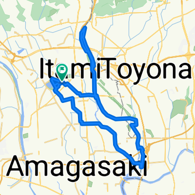
6丁目, 伊丹市 to Unnamed Road
A cycling route starting in Itami, Hyōgo, Japan.
Overview
About this route
- 5 h 42 min
- Duration
- 350.3 km
- Distance
- 3,325 m
- Ascent
- 1,679 m
- Descent
- 61.4 km/h
- Avg. speed
- ---
- Max. altitude

Continue with Bikemap
Use, edit, or download this cycling route
You would like to ride 6丁目, 伊丹市 to Unnamed Road or customize it for your own trip? Here is what you can do with this Bikemap route:
Free features
- Save this route as favorite or in collections
- Copy & plan your own version of this route
- Split it into stages to create a multi-day tour
- Sync your route with Garmin or Wahoo
Premium features
Free trial for 3 days, or one-time payment. More about Bikemap Premium.
- Navigate this route on iOS & Android
- Export a GPX / KML file of this route
- Create your custom printout (try it for free)
- Download this route for offline navigation
Discover more Premium features.
Get Bikemap PremiumFrom our community
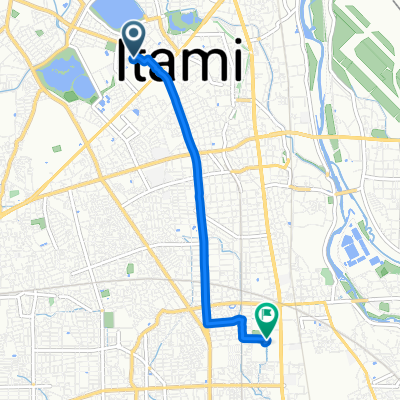
Other popular routes starting in Itami
 dfdgfsfg
- Distance
- 31.4 km
- Ascent
- 143 m
- Descent
- 115 m
- Location
- Itami, Hyōgo, Japan
 20201120
- Distance
- 34.5 km
- Ascent
- 197 m
- Descent
- 193 m
- Location
- Itami, Hyōgo, Japan
 2-18, Misono 2-Chōme, Amagasaki to 8, Higashinanamatsucho 1-Chōme, Amagasaki
- Distance
- 4.4 km
- Ascent
- 4 m
- Descent
- 3 m
- Location
- Itami, Hyōgo, Japan
 6丁目, 伊丹市 to 6丁目, 伊丹市
- Distance
- 15.5 km
- Ascent
- 135 m
- Descent
- 130 m
- Location
- Itami, Hyōgo, Japan
 2丁目 25, 尼崎市 まで1丁目 1, 尼崎市
- Distance
- 2.9 km
- Ascent
- 0 m
- Descent
- 42 m
- Location
- Itami, Hyōgo, Japan
 6丁目, 伊丹市 to 4丁目 8, 伊丹市
- Distance
- 4.3 km
- Ascent
- 12 m
- Descent
- 34 m
- Location
- Itami, Hyōgo, Japan
 6丁目, 伊丹市 to 4丁目 1, 大阪市
- Distance
- 15.2 km
- Ascent
- 0 m
- Descent
- 10 m
- Location
- Itami, Hyōgo, Japan
 2020.11.29 ロードバイク3回目
- Distance
- 18 km
- Ascent
- 86 m
- Descent
- 86 m
- Location
- Itami, Hyōgo, Japan
Open it in the app