

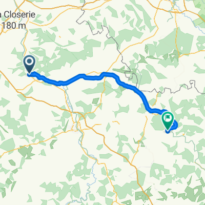
De 4 Chemin de la Ferrante, Saint-Aubin-sur-Yonne à 6 Chemin de la Ferrante, Saint-Aubin-sur-Yonne
A cycling route starting in Cézy, Bourgogne-Franche-Comté, France.
Overview
About this route
- 1 h 44 min
- Duration
- 6.8 km
- Distance
- 102 m
- Ascent
- 101 m
- Descent
- 3.9 km/h
- Avg. speed
- ---
- Max. altitude

Route quality
Waytypes & surfaces along the route
Waytypes
Track
2.9 km
(43 %)
Quiet road
2 km
(29 %)
Path
1.9 km
(28 %)
Surfaces
Paved
1 km
(15 %)
Unpaved
1.7 km
(25 %)
Ground
1.2 km
(17 %)
Paved (undefined)
1 km
(15 %)
Continue with Bikemap
Use, edit, or download this cycling route
You would like to ride De 4 Chemin de la Ferrante, Saint-Aubin-sur-Yonne à 6 Chemin de la Ferrante, Saint-Aubin-sur-Yonne or customize it for your own trip? Here is what you can do with this Bikemap route:
Free features
- Save this route as favorite or in collections
- Copy & plan your own version of this route
- Sync your route with Garmin or Wahoo
Premium features
Free trial for 3 days, or one-time payment. More about Bikemap Premium.
- Navigate this route on iOS & Android
- Export a GPX / KML file of this route
- Create your custom printout (try it for free)
- Download this route for offline navigation
Discover more Premium features.
Get Bikemap PremiumFrom our community
Other popular routes starting in Cézy
 De 1 Chemin de la Ferrante, Saint-Aubin-sur-Yonne à 6 Chemin de la Ferrante, Saint-Aubin-sur-Yonne
- Distance
- 6.8 km
- Ascent
- 111 m
- Descent
- 108 m
- Location
- Cézy, Bourgogne-Franche-Comté, France
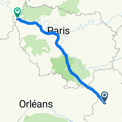
 Cézy - Tanlay
- Distance
- 82.5 km
- Ascent
- 135 m
- Descent
- 61 m
- Location
- Cézy, Bourgogne-Franche-Comté, France
 De D67, Chamvres à Avenue Pasteur 37, Saint-Julien-du-Sault
- Distance
- 12.4 km
- Ascent
- 69 m
- Descent
- 88 m
- Location
- Cézy, Bourgogne-Franche-Comté, France
 Recovered Route
- Distance
- 8.5 km
- Ascent
- 60 m
- Descent
- 32 m
- Location
- Cézy, Bourgogne-Franche-Comté, France
 De Rue des Osiers, Champvallon à Rue des Osiers, Champvallon
- Distance
- 19.3 km
- Ascent
- 214 m
- Descent
- 213 m
- Location
- Cézy, Bourgogne-Franche-Comté, France
 Recovered Route
- Distance
- 6 km
- Ascent
- 13 m
- Descent
- 67 m
- Location
- Cézy, Bourgogne-Franche-Comté, France
 D943, Joigny à Place du 1er Régiment des Volontaires de l'Yonne, Joigny
- Distance
- 2.8 km
- Ascent
- 6 m
- Descent
- 3 m
- Location
- Cézy, Bourgogne-Franche-Comté, France
 De Autoroute du Soleil à Autoroute de Normandie
- Distance
- 199 km
- Ascent
- 756 m
- Descent
- 784 m
- Location
- Cézy, Bourgogne-Franche-Comté, France
Open it in the app