

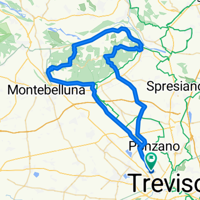
PEGORILE - GIAVERA - PIAVESELLA DI NERVESA
A cycling route starting in Treviso, Veneto, Italy.
Overview
About this route
- -:--
- Duration
- 15.7 km
- Distance
- 20 m
- Ascent
- 13 m
- Descent
- ---
- Avg. speed
- ---
- Max. altitude

Route quality
Waytypes & surfaces along the route
Waytypes
Quiet road
9.3 km
(59 %)
Cycleway
1.5 km
(10 %)
Surfaces
Paved
6.1 km
(39 %)
Unpaved
0.5 km
(3 %)
Asphalt
6.1 km
(39 %)
Unpaved (undefined)
0.4 km
(2 %)
Route highlights
Points of interest along the route

Point of interest after 0.3 km
PONTE SANT'AGATA
Point of interest after 0.5 km
PESCHERIA

Point of interest after 0.5 km
ISOLA DELLA PESCHERIA
Point of interest after 0.7 km
PONTE SAN FRANCESCO
Point of interest after 0.7 km
CHIESA DI AN FRANCESCO

Point of interest after 1.6 km
CAPITELLO
Point of interest after 1.7 km
PONTE SULLA PIAVESELLA

Point of interest after 2.3 km
PARROCCHIALE DI SAN BARTOLOMEO

Point of interest after 3.9 km
PONTE
Point of interest after 5.1 km
B&B AL MAJO
Point of interest after 5.1 km
TROTA DEL MAJO
Point of interest after 5.1 km
AZIENDA ANTENORE VISENTIN

Point of interest after 7.8 km
VILLAGGIO FLORIDA
Continue with Bikemap
Use, edit, or download this cycling route
You would like to ride PEGORILE - GIAVERA - PIAVESELLA DI NERVESA or customize it for your own trip? Here is what you can do with this Bikemap route:
Free features
- Save this route as favorite or in collections
- Copy & plan your own version of this route
- Sync your route with Garmin or Wahoo
Premium features
Free trial for 3 days, or one-time payment. More about Bikemap Premium.
- Navigate this route on iOS & Android
- Export a GPX / KML file of this route
- Create your custom printout (try it for free)
- Download this route for offline navigation
Discover more Premium features.
Get Bikemap PremiumFrom our community
Other popular routes starting in Treviso
 Il Sile da Treviso a Portegrandi
- Distance
- 78.2 km
- Ascent
- 47 m
- Descent
- 48 m
- Location
- Treviso, Veneto, Italy
 Gravelata 2 fiumi e tanti ponti. Lunga
- Distance
- 119.3 km
- Ascent
- 13 m
- Descent
- 11 m
- Location
- Treviso, Veneto, Italy
 TREVISO - URBS PICTA
- Distance
- 4.5 km
- Ascent
- 23 m
- Descent
- 21 m
- Location
- Treviso, Veneto, Italy
 BOTTENIGA - CAGNAN GRANDO - BURANELLI
- Distance
- 5.7 km
- Ascent
- 13 m
- Descent
- 21 m
- Location
- Treviso, Veneto, Italy
 Giro 14/05/11
- Distance
- 65.5 km
- Ascent
- 481 m
- Descent
- 481 m
- Location
- Treviso, Veneto, Italy
 Valle Agredo ritorno
- Distance
- 57.2 km
- Ascent
- 25 m
- Descent
- 30 m
- Location
- Treviso, Veneto, Italy
 Treviso to Villach
- Distance
- 407.8 km
- Ascent
- 6,293 m
- Descent
- 5,817 m
- Location
- Treviso, Veneto, Italy
 From Treviso to Innsbruck
- Distance
- 387.8 km
- Ascent
- 8,754 m
- Descent
- 8,188 m
- Location
- Treviso, Veneto, Italy
Open it in the app