

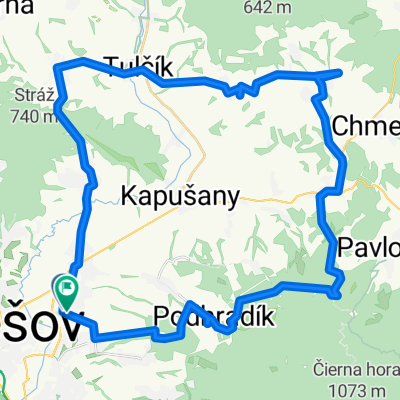
Cez Cervenu mlaku
A cycling route starting in Prešov, Prešov Region, Slovakia.
Overview
About this route
Nice route, only on the road before Podhradikon and from Zlata Bana.
- -:--
- Duration
- 41.1 km
- Distance
- 945 m
- Ascent
- 945 m
- Descent
- ---
- Avg. speed
- ---
- Max. altitude

Route highlights
Points of interest along the route

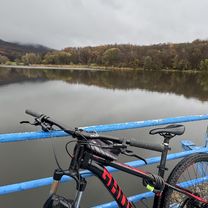
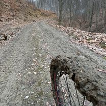
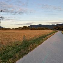
Photo after 24.2 km
Continue with Bikemap
Use, edit, or download this cycling route
You would like to ride Cez Cervenu mlaku or customize it for your own trip? Here is what you can do with this Bikemap route:
Free features
- Save this route as favorite or in collections
- Copy & plan your own version of this route
- Sync your route with Garmin or Wahoo
Premium features
Free trial for 3 days, or one-time payment. More about Bikemap Premium.
- Navigate this route on iOS & Android
- Export a GPX / KML file of this route
- Create your custom printout (try it for free)
- Download this route for offline navigation
Discover more Premium features.
Get Bikemap PremiumFrom our community
Other popular routes starting in Prešov
 Domasa okruh
- Distance
- 107.2 km
- Ascent
- 821 m
- Descent
- 820 m
- Location
- Prešov, Prešov Region, Slovakia
 Route in Ľubotice
- Distance
- 49.6 km
- Ascent
- 1,040 m
- Descent
- 1,040 m
- Location
- Prešov, Prešov Region, Slovakia
 wysowa
- Distance
- 119.6 km
- Ascent
- 1,655 m
- Descent
- 1,655 m
- Location
- Prešov, Prešov Region, Slovakia
 presov sigord
- Distance
- 13 km
- Ascent
- 129 m
- Descent
- 144 m
- Location
- Prešov, Prešov Region, Slovakia
 borkut - malkovska - presov
- Distance
- 17.5 km
- Ascent
- 815 m
- Descent
- 787 m
- Location
- Prešov, Prešov Region, Slovakia
 zlaté kopyto
- Distance
- 29.7 km
- Ascent
- 338 m
- Descent
- 92 m
- Location
- Prešov, Prešov Region, Slovakia
 D1 do Kojatice
- Distance
- 48.8 km
- Ascent
- 504 m
- Descent
- 559 m
- Location
- Prešov, Prešov Region, Slovakia
 PO - Sigord
- Distance
- 12.9 km
- Ascent
- 134 m
- Descent
- 130 m
- Location
- Prešov, Prešov Region, Slovakia
Open it in the app