

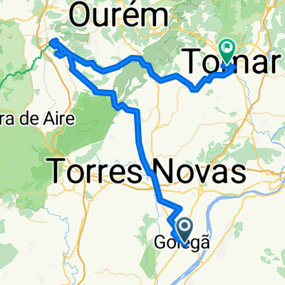
Overview
About this route
- -:--
- Duration
- 31.7 km
- Distance
- 181 m
- Ascent
- 96 m
- Descent
- ---
- Avg. speed
- ---
- Max. altitude

Part of
Tour of Portugal
14 stages
Route quality
Waytypes & surfaces along the route
Waytypes
Road
11.7 km
(37 %)
Quiet road
7 km
(22 %)
Surfaces
Paved
16.8 km
(53 %)
Unpaved
0.6 km
(2 %)
Asphalt
16.5 km
(52 %)
Gravel
0.6 km
(2 %)
Route highlights
Points of interest along the route
Accommodation after 31.7 km
Stay maybe in family flat in Santarem
Continue with Bikemap
Use, edit, or download this cycling route
You would like to ride Golega - Santarem or customize it for your own trip? Here is what you can do with this Bikemap route:
Free features
- Save this route as favorite or in collections
- Copy & plan your own version of this route
- Sync your route with Garmin or Wahoo
Premium features
Free trial for 3 days, or one-time payment. More about Bikemap Premium.
- Navigate this route on iOS & Android
- Export a GPX / KML file of this route
- Create your custom printout (try it for free)
- Download this route for offline navigation
Discover more Premium features.
Get Bikemap PremiumFrom our community
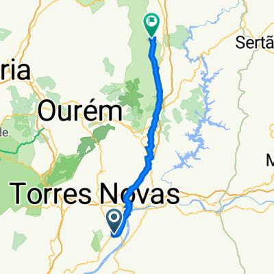
Other popular routes starting in Golegã
 Golega - Santarem
- Distance
- 31.7 km
- Ascent
- 181 m
- Descent
- 96 m
- Location
- Golegã, Santarém District, Portugal
 Camino D2
- Distance
- 83.7 km
- Ascent
- 695 m
- Descent
- 453 m
- Location
- Golegã, Santarém District, Portugal
 Moderate route
- Distance
- 82.6 km
- Ascent
- 886 m
- Descent
- 793 m
- Location
- Golegã, Santarém District, Portugal
 port 2
- Distance
- 92.7 km
- Ascent
- 1,307 m
- Descent
- 1,033 m
- Location
- Golegã, Santarém District, Portugal
 Day 2 | Golegã to Alvaiázere
- Distance
- 54.5 km
- Ascent
- 464 m
- Descent
- 240 m
- Location
- Golegã, Santarém District, Portugal
 lisboa idanha 4 dia 3
- Distance
- 49.2 km
- Ascent
- 552 m
- Descent
- 291 m
- Location
- Golegã, Santarém District, Portugal
 D10 - Golega a Ansiao
- Distance
- 76.3 km
- Ascent
- 1,235 m
- Descent
- 1,040 m
- Location
- Golegã, Santarém District, Portugal
 1807hh GOLEGA ALVAIAZERE
- Distance
- 57.5 km
- Ascent
- 490 m
- Descent
- 195 m
- Location
- Golegã, Santarém District, Portugal
Open it in the app