

Parchi di Roma
A cycling route starting in Rome, Lazio, Italy.
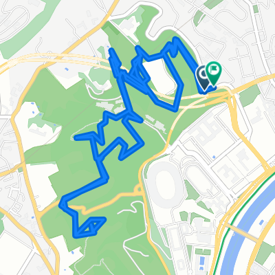
Overview
About this route
Start time: 11/29/2020 08:11 End time: 11/29/2020 13:32 Distance: 46.1 km (05:21) Moving time: 03:38 Average speed: 8.62 km/h Moving average speed: 12.65 km/h Max speed: 42.09 km/h Minimum altitude: 12 m Maximum altitude: 122 m Climbing speed: 306.5 m/h Descending speed: -342.8 m/h Positive elevation gain: 850 m Negative elevation loss: -849 m Climbing time: 02:46 Descending time: 02:28
- -:--
- Duration
- 43 km
- Distance
- 747 m
- Ascent
- 747 m
- Descent
- ---
- Avg. speed
- ---
- Max. altitude

Continue with Bikemap
Use, edit, or download this cycling route
You would like to ride Parchi di Roma or customize it for your own trip? Here is what you can do with this Bikemap route:
Free features
- Save this route as favorite or in collections
- Copy & plan your own version of this route
- Sync your route with Garmin or Wahoo
Premium features
Free trial for 3 days, or one-time payment. More about Bikemap Premium.
- Navigate this route on iOS & Android
- Export a GPX / KML file of this route
- Create your custom printout (try it for free)
- Download this route for offline navigation
Discover more Premium features.
Get Bikemap PremiumFrom our community
Other popular routes starting in Rome
 Anello Roma Sud Est
- Distance
- 28.2 km
- Ascent
- 140 m
- Descent
- 140 m
- Location
- Rome, Lazio, Italy
 tuttappiantica
- Distance
- 44.3 km
- Ascent
- 541 m
- Descent
- 492 m
- Location
- Rome, Lazio, Italy
 VILLE ROMANE E ROMA GARIBALDINA
- Distance
- 18.2 km
- Ascent
- 221 m
- Descent
- 209 m
- Location
- Rome, Lazio, Italy
 Percorsi Monte Mario
- Distance
- 9.3 km
- Ascent
- 272 m
- Descent
- 289 m
- Location
- Rome, Lazio, Italy
 tuscolano - torre maura - parco tor tre teste
- Distance
- 16.1 km
- Ascent
- 61 m
- Descent
- 62 m
- Location
- Rome, Lazio, Italy
 Villa Pamphili East
- Distance
- 3.3 km
- Ascent
- 75 m
- Descent
- 78 m
- Location
- Rome, Lazio, Italy
 St. Francesco's Way
- Distance
- 177.7 km
- Ascent
- 1,518 m
- Descent
- 1,157 m
- Location
- Rome, Lazio, Italy
 Roma - Bracciano - Tolfa - Ladispoli - Roma
- Distance
- 174.3 km
- Ascent
- 979 m
- Descent
- 976 m
- Location
- Rome, Lazio, Italy
Open it in the app