

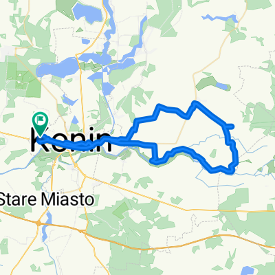
Konin - Koło
A cycling route starting in Konin, Greater Poland Voivodeship, Poland.
Overview
About this route
Konin-Wola Podłężna-Pogorzałki-Ochle-Dzierawy-Koło-CASTLE KOŁO-Kościelec-Krzymów-Rożek Krzymowski-Szczepidło-Konin
- -:--
- Duration
- 77.5 km
- Distance
- 70 m
- Ascent
- 70 m
- Descent
- ---
- Avg. speed
- ---
- Max. altitude

Route quality
Waytypes & surfaces along the route
Waytypes
Road
35.6 km
(46 %)
Quiet road
25.6 km
(33 %)
Surfaces
Paved
55 km
(71 %)
Unpaved
7 km
(9 %)
Asphalt
55 km
(71 %)
Gravel
5.4 km
(7 %)
Continue with Bikemap
Use, edit, or download this cycling route
You would like to ride Konin - Koło or customize it for your own trip? Here is what you can do with this Bikemap route:
Free features
- Save this route as favorite or in collections
- Copy & plan your own version of this route
- Sync your route with Garmin or Wahoo
Premium features
Free trial for 3 days, or one-time payment. More about Bikemap Premium.
- Navigate this route on iOS & Android
- Export a GPX / KML file of this route
- Create your custom printout (try it for free)
- Download this route for offline navigation
Discover more Premium features.
Get Bikemap PremiumFrom our community
Other popular routes starting in Konin
 Konin-Oleśnica(2etapGrudziądz-Nachod)
- Distance
- 151.3 km
- Ascent
- 294 m
- Descent
- 218 m
- Location
- Konin, Greater Poland Voivodeship, Poland
 Wschodnie bliskie tereny Konina
- Distance
- 52.6 km
- Ascent
- 107 m
- Descent
- 108 m
- Location
- Konin, Greater Poland Voivodeship, Poland
 Południowo-Zachodnie Okolice Konina
- Distance
- 73.8 km
- Ascent
- 88 m
- Descent
- 88 m
- Location
- Konin, Greater Poland Voivodeship, Poland
 Jeziora konińskie
- Distance
- 28 km
- Ascent
- 102 m
- Descent
- 105 m
- Location
- Konin, Greater Poland Voivodeship, Poland
 Piła 2024 d (25-26.05)
- Distance
- 234.6 km
- Ascent
- 551 m
- Descent
- 595 m
- Location
- Konin, Greater Poland Voivodeship, Poland
 Konin - Koło
- Distance
- 77.5 km
- Ascent
- 70 m
- Descent
- 70 m
- Location
- Konin, Greater Poland Voivodeship, Poland
 Koło walem
- Distance
- 69.1 km
- Ascent
- 58 m
- Descent
- 55 m
- Location
- Konin, Greater Poland Voivodeship, Poland
 Konin - Ostrow Wielkopolski
- Distance
- 106.2 km
- Ascent
- 217 m
- Descent
- 184 m
- Location
- Konin, Greater Poland Voivodeship, Poland
Open it in the app