

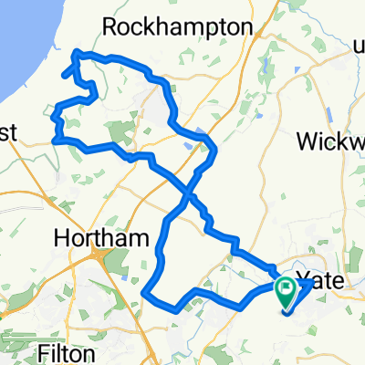
Part 2, from Iron Acton
A cycling route starting in Yate, England, United Kingdom.
Overview
About this route
For M'Up ride, Sat 5th Dec
- -:--
- Duration
- 18.4 km
- Distance
- 52 m
- Ascent
- 100 m
- Descent
- ---
- Avg. speed
- ---
- Avg. speed

Route quality
Waytypes & surfaces along the route
Waytypes
Cycleway
12.8 km
(70 %)
Road
3.6 km
(20 %)
Surfaces
Paved
13.7 km
(74 %)
Unpaved
1.6 km
(9 %)
Asphalt
13.7 km
(74 %)
Gravel
1.6 km
(9 %)
Undefined
3.1 km
(17 %)
Continue with Bikemap
Use, edit, or download this cycling route
You would like to ride Part 2, from Iron Acton or customize it for your own trip? Here is what you can do with this Bikemap route:
Free features
- Save this route as favorite or in collections
- Copy & plan your own version of this route
- Sync your route with Garmin or Wahoo
Premium features
Free trial for 3 days, or one-time payment. More about Bikemap Premium.
- Navigate this route on iOS & Android
- Export a GPX / KML file of this route
- Create your custom printout (try it for free)
- Download this route for offline navigation
Discover more Premium features.
Get Bikemap PremiumFrom our community
Other popular routes starting in Yate
 Route 1 loop
- Distance
- 16.4 km
- Ascent
- 75 m
- Descent
- 72 m
- Location
- Yate, England, United Kingdom
 Sat forest fun option 2
- Distance
- 148.6 km
- Ascent
- 1,209 m
- Descent
- 1,207 m
- Location
- Yate, England, United Kingdom
 Easy Sunday
- Distance
- 3.7 km
- Ascent
- 120 m
- Descent
- 124 m
- Location
- Yate, England, United Kingdom
 Yate loop (recce)
- Distance
- 56.9 km
- Ascent
- 269 m
- Descent
- 270 m
- Location
- Yate, England, United Kingdom
 Part 2, from Iron Acton
- Distance
- 18.4 km
- Ascent
- 52 m
- Descent
- 100 m
- Location
- Yate, England, United Kingdom
 Maisemore 149 to Maisemore 147
- Distance
- 75 km
- Ascent
- 468 m
- Descent
- 470 m
- Location
- Yate, England, United Kingdom
 Chedworth 1, Yate to Chedworth 22, Yate
- Distance
- 51.7 km
- Ascent
- 420 m
- Descent
- 418 m
- Location
- Yate, England, United Kingdom
 Yate loop trunc (recce)
- Distance
- 39.3 km
- Ascent
- 198 m
- Descent
- 200 m
- Location
- Yate, England, United Kingdom
Open it in the app