

Hexenpfad
A cycling route starting in Winningen, Rhineland-Palatinate, Germany.
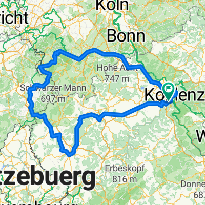
Overview
About this route
initially road, then in the woods along an unpaved path. the descent of the witches' path winds down in many switchbacks to the Belltal valley, where you can then ride back up on a nice forest path...
- -:--
- Duration
- 8.8 km
- Distance
- 352 m
- Ascent
- 352 m
- Descent
- ---
- Avg. speed
- ---
- Max. altitude
Route highlights
Points of interest along the route
Point of interest after 4.2 km
rechts abbigen und immer auf dem hexenpfad bleiben!
Point of interest after 8.4 km
Continue with Bikemap
Use, edit, or download this cycling route
You would like to ride Hexenpfad or customize it for your own trip? Here is what you can do with this Bikemap route:
Free features
- Save this route as favorite or in collections
- Copy & plan your own version of this route
- Sync your route with Garmin or Wahoo
Premium features
Free trial for 3 days, or one-time payment. More about Bikemap Premium.
- Navigate this route on iOS & Android
- Export a GPX / KML file of this route
- Create your custom printout (try it for free)
- Download this route for offline navigation
Discover more Premium features.
Get Bikemap PremiumFrom our community
Other popular routes starting in Winningen
 ER WinningenKoplenz
- Distance
- 14.4 km
- Ascent
- 40 m
- Descent
- 49 m
- Location
- Winningen, Rhineland-Palatinate, Germany
 Niederfell 47 km Tour
- Distance
- 47.1 km
- Ascent
- 365 m
- Descent
- 367 m
- Location
- Winningen, Rhineland-Palatinate, Germany
 Eifel
Eifel- Distance
- 394.8 km
- Ascent
- 1,468 m
- Descent
- 1,472 m
- Location
- Winningen, Rhineland-Palatinate, Germany
 Moselweinstraße, Koblenz nach Am Plan 1, Koblenz
- Distance
- 10.7 km
- Ascent
- 73 m
- Descent
- 28 m
- Location
- Winningen, Rhineland-Palatinate, Germany
 Hexenpfad
- Distance
- 8.8 km
- Ascent
- 352 m
- Descent
- 352 m
- Location
- Winningen, Rhineland-Palatinate, Germany
 Winningen - Koblentz HB
- Distance
- 12.3 km
- Ascent
- 49 m
- Descent
- 54 m
- Location
- Winningen, Rhineland-Palatinate, Germany
 Am Moselufer 9, Winningen nach Am Moselufer 8–11, Winningen
- Distance
- 31.6 km
- Ascent
- 176 m
- Descent
- 179 m
- Location
- Winningen, Rhineland-Palatinate, Germany
 Mosel-Rhein-Nahe-Glan-Tour 2016
- Distance
- 281.5 km
- Ascent
- 358 m
- Descent
- 218 m
- Location
- Winningen, Rhineland-Palatinate, Germany
Open it in the app